
EL Paso International to Chicago O'Hare International ELP → ORD
1,073 nautical miles (1,235 statute miles) northeast on a straight line, true course 050°, about 042° magnetic at the departure end (variation 8E). At 120 knots that is 6 h 06 min at the quickest height in today's winds (30,000 ft, a 56-knot tailwind), arriving about 10:28 am CDT (15:28 UTC). For planning, not a briefing: the legal preflight briefing comes from Flight Service (1-800-WX-BRIEF) or the FAA's own tools. Airlines fly this pair: 1,417 flights in the DOT's last twelve reported months, the route's page.
The route the straight line, the warnings crossed, restrictions, pilot reports and the airports along the way · click a mark for its words
Green, blue, red and purple airport dots are the flying conditions reported there now (VFR, marginal VFR, IFR, low IFR); grey means no report. Red areas are SIGMETs, orange areas AIRMETs, hatched red areas temporary flight restrictions. Map tiles: OpenFreeMap, data © OpenStreetMap contributors.
Warnings the route crosses SIGMETs and AIRMETs whose area the line passes through or comes within 25 nm of
- AIRMET TANGO 2W: moderate turbulence below 18,000 ft (due to mountain wave) up to 22,000 ft. Near the route, 70 nm along the route.
- AIRMET TANGO 1W: low-level wind shear (due to air speed loss or gain of 20 knots or more below 2,000 ft above the ground). Over the last 695 nm of the route.
Turbulence AIRMET in force: moderate turbulence (due to mountain wave) up to 22,000 ft, near the route, 70 nm along the route. AIRMET in force: low-level wind shear (due to air speed loss or gain of 20 knots or more below 2,000 ft above the ground), over the last 695 nm of the route. No pilot has reported turbulence near the line in the last three hours. The government's turbulence forecast map ↗
Icing No icing warning in force along the route. No pilot has reported icing near the line in the last three hours. The freezing level is about 14,500 ft (from the winds-aloft temperatures), so icing is possible in cloud above that. The government's icing forecast map ↗
A SIGMET warns of weather hazardous to all aircraft; an AIRMET of weather that matters to small aircraft and to flying without instruments. "From 60 to 180 nm out" is measured along the route from ELP.
Pilot reports along the route within 50 nm of the line, last three hours, the serious ones first
Not fetched just now.
Winds aloft along the route, and the time en route the forecast for use 08:00–15:00 UTC · at 120 knots true airspeed
The eastbound cruising heights for this course (VFR: odd thousands plus 500 ft; above 18,000 ft the forecast levels), with the wind averaged along the line from the 10 forecast points nearest it (ELP, ROW, LBB, AMA, GAG, ICT, MKC, COU, BRL, JOT). A plus sign is a headwind, a minus sign a tailwind.
| Height | Average wind | Head- or tailwind | Temperature | Ground speed | Time en route | Arrival |
|---|---|---|---|---|---|---|
| 3,500 ft | 260° at 29 kt | −28 kt | 148 kt | 7 h 15 min | 11:37 am CDT (16:37 UTC) | |
| 5,500 ft | 250° at 21 kt | −21 kt | 21 °C | 141 kt | 7 h 37 min | 11:59 am CDT (16:59 UTC) |
| 7,500 ft | 240° at 23 kt | −23 kt | 16 °C | 143 kt | 7 h 30 min | 11:52 am CDT (16:52 UTC) |
| 9,500 ft | 240° at 27 kt | −27 kt | 12 °C | 147 kt | 7 h 18 min | 11:40 am CDT (16:40 UTC) |
| 11,500 ft | 240° at 31 kt | −32 kt | 7 °C | 152 kt | 7 h 04 min | 11:26 am CDT (16:26 UTC) |
| 13,500 ft | 240° at 33 kt | −33 kt | 3 °C | 153 kt | 7 h 01 min | 11:23 am CDT (16:23 UTC) |
| 15,500 ft | 240° at 34 kt | −34 kt | -2 °C | 154 kt | 6 h 58 min | 11:20 am CDT (16:20 UTC) |
| 17,500 ft | 240° at 35 kt | −35 kt | -6 °C | 155 kt | 6 h 55 min | 11:17 am CDT (16:17 UTC) |
| 18,000 ft FL180 | 240° at 35 kt | −35 kt | -7 °C | 155 kt | 6 h 55 min | 11:17 am CDT (16:17 UTC) |
| 24,000 ft FL240 | 250° at 49 kt | −49 kt | -18 °C | 169 kt | 6 h 21 min | 10:43 am CDT (15:43 UTC) |
| 30,000 ft FL300 | 250° at 57 kt | −56 kt | -29 °C | 176 kt | 6 h 06 min | 10:28 am CDT (15:28 UTC) |
| 34,000 ft FL340 | 250° at 56 kt | −54 kt | -37 °C | 174 kt | 6 h 10 min | 10:32 am CDT (15:32 UTC) |
| 39,000 ft FL390 | 250° at 53 kt | −52 kt | -49 °C | 172 kt | 6 h 14 min | 10:36 am CDT (15:36 UTC) |
Based on data from the 13th at 06:00 UTC; valid on the 13th at 12:00 UTC for use 08:00 to 15:00 UTC; temperatures above 24,000 ft are below zero. Heights are above sea level; a height is left out when the forecast has no wind for it over most of the line (the ground is higher). Ground speed is the airspeed less the headwind; the time en route is for the straight line and ignores climb, descent and routing around weather.
The forecast points as issued
| Point | From | 3,000 | 6,000 | 9,000 | 12,000 | 18,000 | 24,000 | 30,000 | 34,000 | 39,000 |
|---|---|---|---|---|---|---|---|---|---|---|
| ELP | used from 0 nm out; 25 nm from the line | 280/15 | 220/26 12° | 210/35 7° | 220/44 -5° | 220/55 -15° | 210/57 -28° | 210/51 -37° | 220/48 -50° | |
| ROW | used from 50 nm out; 55 nm from the line | 230/7 | 210/22 13° | 210/36 7° | 220/38 -5° | 220/55 -16° | 210/60 -29° | 220/56 -37° | 220/57 -50° | |
| LBB | used from 199 nm out; 62 nm from the line | 230/28 20° | 230/21 15° | 210/23 8° | 210/30 -6° | 230/47 -16° | 220/51 -28° | 220/47 -37° | 230/49 -50° | |
| AMA | used from 248 nm out; 40 nm from the line | 220/25 | 220/28 14° | 220/35 7° | 220/37 -7° | 230/59 -17° | 220/63 -28° | 230/58 -37° | 230/61 -50° | |
| GAG | used from 348 nm out; 53 nm from the line | 230/28 21° | 230/28 14° | 230/37 7° | 230/32 -7° | 240/55 -18° | 230/64 -29° | 230/62 -37° | 230/62 -50° | |
| ICT | used from 497 nm out; 43 nm from the line | 230/35 | 240/22 21° | 240/25 14° | 230/31 6° | 240/34 -7° | 250/51 -18° | 250/66 -29° | 250/64 -37° | 250/54 -49° |
| MKC | used from 646 nm out; 54 nm from the line | 250/26 | 260/24 19° | 240/26 13° | 250/31 5° | 250/31 -7° | 260/46 -20° | 270/73 -28° | 270/67 -37° | 270/57 -49° |
| COU | used from 795 nm out; 66 nm from the line | 270/30 | 290/13 18° | 250/16 14° | 240/23 6° | 270/33 -7° | 280/44 -20° | 280/69 -29° | 280/65 -38° | 280/55 -49° |
| BRL | used from 844 nm out; 43 nm from the line | 270/33 | 270/24 18° | 260/33 11° | 270/41 5° | 260/44 -9° | 270/52 -20° | 290/79 -28° | 290/76 -37° | 290/73 -49° |
| JOT | used from 993 nm out; 36 nm from the line | 280/38 | 270/37 18° | 270/43 12° | 270/45 3° | 260/44 -8° | 280/52 -21° | 300/70 -29° | 300/81 -38° | 300/84 -49° |
The weather now: both ends and the airports along the way public airports with a weather report within 25 nm of the line, one for each stretch
| Airport | Where | Conditions | Wind | Visibility | Ceiling | Elevation | Reported |
|---|---|---|---|---|---|---|---|
| ELP El Paso, TX | departure | no report just now | 3,961 ft | ||||
| ROW Roswell, NM | 129 nm out, 10 nm northwest of the line, tower | no report just now | 3,671 ft | ||||
| AMA Amarillo, TX | 308 nm out, 14 nm northwest of the line, tower | no report just now | 3,606 ft | ||||
| HHF Canadian, TX | 387 nm out, 9 nm northwest of the line | no report just now | 2,396 ft | ||||
| AVK Alva, OK | 487 nm out, 3 nm west of the line | no report just now | 1,476 ft | ||||
| BEC Wichita, KS | 576 nm out, 8 nm northwest of the line, tower | no report just now | 1,408 ft | ||||
| OJC Olathe, KS | 705 nm out, 3 nm east of the line, tower | no report just now | 1,096 ft | ||||
| IRK Kirksville, MO | 835 nm out, 8 nm northwest of the line | no report just now | 966 ft | ||||
| GBG Galesburg, IL | 944 nm out, 2 nm northwest of the line | no report just now | 764 ft | ||||
| ARR Chicago/Aurora, IL | 1043 nm out, 2 nm north of the line, tower | no report just now | 712 ft | ||||
| ORD Chicago, IL | destination | no report just now | 680 ft |
The highest airport on this list sits at 3,961 ft; the ground between airports is higher still. Check the sectional chart for the terrain and the minimum safe heights along the line.
The codes as issued, and in English, for every airport in the table
At ORD when you get there the forecast at the estimated arrival, 10:28 am CDT (15:28 UTC)
ORD has no terminal forecast; use the nearest airport that does.
Temporary flight restrictions on the line or within 25 nm of it
- 6/8722 ALAMOGORDO, NM, Tuesday, October 13, 2026 Local 22 nm from the route, 79 nm along the route · security · today · ZAB
Notices to air missions closures and things out of service at both ends; airspace, navigation aids and obstructions near the line
ELP: 34 notices in force, 6 starting within a week. all of them, grouped →
ORD: 64 notices in force, 2 starting within a week. runway 04R/22L closed runway 09L/27R closed runway 09R/27L closed runway 10R/28L closed all of them, grouped →
- closed Taxiway B1 closed until Tue 13 Oct, 6:00 am CDT (11:00 UTC) · ORD 10/467
as issued
!ORD 10/467 ORD TWY B1 CLSD 2610130448-2610131100
- closed Taxiway B between taxiway A6 and taxiway A9 closed until Tue 13 Oct, 6:00 am CDT (11:00 UTC) · ORD 10/468
as issued
!ORD 10/468 ORD TWY B BTN TWY A6 AND TWY A9 CLSD 2610130448-2610131100
- closed Taxiway A8 closed until Tue 13 Oct, 6:00 am CDT (11:00 UTC) · ORD 10/466
as issued
!ORD 10/466 ORD TWY A8 CLSD 2610130447-2610131100
- closed Taxiway A7 closed until Tue 13 Oct, 6:00 am CDT (11:00 UTC) · ORD 10/465
as issued
!ORD 10/465 ORD TWY A7 CLSD 2610130447-2610131100
Airports along the way: ARR runway 18/36 closed
176 notices near the line, the first 30 (airspace and special activity within 25 nm, navigation aids within 25 nm, obstructions within 5 nm):
- Obstruction tower lights (ASR 1284833) 31°52′N 106°19′W (3.2 nautical miles northeast BIF) 4,059 ft (63 ft above ground level) out of service until Fri 20 Nov, 8:17 pm MST (03:17 UTC) · 0 nm along the route, 3 nm off the line · BIF 10/074
as issued
!ABQ 10/074 BIF OBST TOWER LGT (ASR 1284833) 315235.10N1061936.20W (3.2NM NE BIF) 4059FT (63FT AGL) U/S 2610062117-2611210317
- Obstruction tower lights (ASR 1284833) 31°52′N 106°19′W (3.2 nautical miles northeast BIF) 4,059 ft (63 ft above ground level) out of service until Thu 19 Nov, 3:22 pm MST (22:22 UTC), estimated · 0 nm along the route, 5 nm off the line · BIF 10/059
as issued
!ABQ 10/059 BIF OBST TOWER LGT (ASR 1284833) 315235.10N1061936.20W (3.2NM NE BIF) 4059FT (63FT AGL) U/S 2610051625-2611192222EST
- Navigation aid ILS runway 21 glide path out of service until Wed 21 Oct, 5:00 pm MDT (23:00 UTC) · 129 nm along the route, 10 nm off the line · ROW 10/002
as issued
!ROW 10/002 ROW NAV ILS RWY 21 GP U/S 2610061317-2610212300
- Navigation aid VOR ground receive Checkpoint out of service until Mon 5 Apr, 3:11 pm MDT (21:11 UTC), estimated · 129 nm along the route, 10 nm off the line · ROW 10/001
as issued
!ROW 10/001 ROW NAV VOR GND REC CHECKPOINT U/S 2610051219-2704052111EST
- Navigation aid ILS runway 21 outer marker out of service until Mon 6 Dec 2027, 2:11 pm MST (21:11 UTC), estimated · 129 nm along the route, 10 nm off the line · ROW 04/028
as issued
!ROW 04/028 ROW NAV ILS RWY 21 OM U/S 2605062111-2712062111EST
- Navigation aid ILS runway 04 glide path out of service until Sun 6 Dec, 2:00 pm MST (21:00 UTC) · 228 nm along the route, 18 nm off the line · CVN 10/002
as issued
!CVN 10/002 CVN NAV ILS RWY 04 GP U/S 2610061330-2612062100
- Obstruction tower lights (ASR 1300859) 34°33′N 102°17′W (1.4 nautical miles southeast T55) 4,192 ft (331 ft above ground level) out of service until Mon 23 Nov, 1:56 pm MST (20:56 UTC), estimated · 258 nm along the route, 5 nm off the line · T55 10/359
as issued
!FTW 10/359 T55 OBST TOWER LGT (ASR 1300859) 343322.40N1021754.50W (1.4NM SE T55) 4192FT (331FT AGL) U/S 2610091457-2611232056EST
- Obstruction tower lights (ASR 1048973) 34°48′N 102°00′W (16 nautical miles east HRX) 4,044 ft (281 ft above ground level) out of service until Thu 19 Nov, 3:34 pm MST (22:34 UTC), estimated · 288 nm along the route, 6 nm off the line · HRX 10/268
as issued
!FTW 10/268 HRX OBST TOWER LGT (ASR 1048973) 344836.00N1020030.00W (16NM E HRX) 4044FT (281FT AGL) U/S 2610051637-2611192234EST
- Navigation aid ILS runway 04 outer marker out of service until Mon 21 Feb 2028, 2:11 pm MST (21:11 UTC), estimated · 308 nm along the route, 15 nm off the line · AMA 08/003
as issued
!AMA 08/003 AMA NAV ILS RWY 04 OM U/S 2608061524-2802212111EST
- Obstruction tower lights (ASR 1207187) 35°13′N 101°22′W (1.6 nautical miles ENE 55T) 3799.9FT (337.9FT above ground level) out of service until Tue 15 Dec, 7:12 am MST (14:12 UTC) · 328 nm along the route, 7 nm off the line · 55T 08/369
as issued
!FTW 08/369 55T OBST TOWER LGT (ASR 1207187) 351330.80N1012253.00W (1.6NM ENE 55T) 3799.9FT (337.9FT AGL) U/S 2608171412-2612151412
- Obstruction tower lights (ASR 1256992) 35°12′N 101°08′W (13.7 nautical miles east 55T) 3617.5FT (331.7FT above ground level) out of service until Thu 19 Nov, 2:54 pm MST (21:54 UTC) · 328 nm along the route, 6 nm off the line · 55T 07/660
as issued
!FTW 07/660 55T OBST TOWER LGT (ASR 1256992) 351241.70N1010801.50W (13.7NM E 55T) 3617.5FT (331.7FT AGL) U/S 2607222154-2611192154
- Obstruction tower lights (ASR 1048465) 35°27′N 100°56′W (2.4 nautical miles east 28X) 3,454 ft (254 ft above ground level) out of service until Thu 19 Nov, 2:47 pm MST (21:47 UTC), estimated · 348 nm along the route, 4 nm off the line · 28X 10/249
as issued
!FTW 10/249 28X OBST TOWER LGT (ASR 1048465) 352744.00N1005644.00W (2.4NM E 28X) 3454FT (254FT AGL) U/S 2610051547-2611192147EST
- Obstruction tower lights (ASR 1277935) 35°26′N 100°48′W (9.5 nautical miles east 28X) 3164.0FT (254.9FT above ground level) out of service until Wed 14 Oct, 5:59 pm MDT (23:59 UTC) · 358 nm along the route, 4 nm off the line · 28X 09/989
as issued
!FTW 09/989 28X OBST TOWER LGT (ASR 1277935) 352645.50N1004800.50W (9.5NM E 28X) 3164.0FT (254.9FT AGL) U/S 2609300553-2610142359
- Obstruction tower lights (ASR 1282642) 35°28′N 100°30′W (13.6 nautical miles northeast 2E7) 3206.7FT (498.0FT above ground level) out of service until Thu 31 Dec, 4:59 pm MST (23:59 UTC) · 368 nm along the route, 9 nm off the line · 2E7 10/322
as issued
!FTW 10/322 2E7 OBST TOWER LGT (ASR 1282642) 352819.10N1003020.90W (13.6NM NE 2E7) 3206.7FT (498.0FT AGL) U/S 2610081850-2612312359
- Obstruction tower lights (ASR 1310604) 35°48′N 100°23′W (5.5 nautical miles south HHF) 3,207 ft (400 ft above ground level) out of service until Thu 19 Nov, 2:16 pm MST (21:16 UTC), estimated · 387 nm along the route, 6 nm off the line · HHF 10/003
as issued
!HHF 10/003 HHF OBST TOWER LGT (ASR 1310604) 354816.30N1002318.80W (5.5NM S HHF) 3207FT (400FT AGL) U/S 2610051519-2611192116EST
- Obstruction tower lights (ASN 2019-ASW-968-OE) 35°54′N 100°24′W (0.9 nautical miles north HHF) 2,517 ft (175 ft above ground level) out of service until Sun 15 Nov, 4:29 pm MST (23:29 UTC) · 387 nm along the route, 9 nm off the line · HHF 10/001
as issued
!HHF 10/001 HHF OBST TOWER LGT (ASN 2019-ASW-968-OE) 355435N1002415W (0.9NM N HHF) 2517FT (175FT AGL) U/S 2610012329-2611152329
- Obstruction tower lights (ASR 1010700) 36°00′N 99°41′W (17.4 nautical miles ESE 1X1) 2824.1FT (349.1FT above ground level) out of service until Wed 11 Nov, 12:19 pm MST (19:19 UTC) · 417 nm along the route, 7 nm off the line · 1X1 09/797
as issued
!FTW 09/797 1X1 OBST TOWER LGT (ASR 1010700) 360042.00N0994112.00W (17.4NM ESE 1X1) 2824.1FT (349.1FT AGL) U/S 2609271920-2611111919
- Obstruction tower lights (ASR 1010681) 36°23′N 99°20′W (9.2 nautical miles east WWR) 2,573 ft (491 ft above ground level) out of service until Thu 19 Nov, 1:30 pm MST (20:30 UTC), estimated · 447 nm along the route, 3 nm off the line · WWR 10/007
as issued
!WWR 10/007 WWR OBST TOWER LGT (ASR 1010681) 362320.80N0992037.00W (9.2NM E WWR) 2573FT (491FT AGL) U/S 2610051431-2611192030EST
- Obstruction tower lights (ASR 1011846) 36°23′N 99°23′W (7.0 nautical miles ESE WWR) 2512.8FT (350.1FT above ground level) out of service until Fri 20 Nov, 4:59 pm MST (23:59 UTC) · 447 nm along the route, 5 nm off the line · WWR 09/005
as issued
!WWR 09/005 WWR OBST TOWER LGT (ASR 1011846) 362355.00N0992311.00W (7.0NM ESE WWR) 2512.8FT (350.1FT AGL) U/S 2609071736-2611202359
- Obstruction tower lights (ASR 1010683) 36°31′N 99°01′W (8.4 nautical miles east MDF) 2,125 ft (400 ft above ground level) out of service until Thu 19 Nov, 1:54 pm MST (20:54 UTC), estimated · 457 nm along the route, 5 nm off the line · MDF 10/092
as issued
!MLC 10/092 MDF OBST TOWER LGT (ASR 1010683) 363134.00N0990139.00W (8.4NM E MDF) 2125FT (400FT AGL) U/S 2610051458-2611192054EST
- Obstruction tower lights (ASR 1245157) 36°25′N 99°09′W (4.1 nautical miles SSE MDF) 2212.6FT (299.9FT above ground level) out of service until Sat 17 Oct, 8:23 am MDT (14:23 UTC) · 457 nm along the route, 4 nm off the line · MDF 10/048
as issued
!MLC 10/048 MDF OBST TOWER LGT (ASR 1245157) 362525.10N0990922.80W (4.1NM SSE MDF) 2212.6FT (299.9FT AGL) U/S 2610021423-2610171423
- Obstruction tower lights (ASR 1010683) 36°31′N 99°01′W (8.4 nautical miles ENE MDF) 2125.0FT (399.9FT above ground level) out of service until Wed 11 Nov, 12:51 pm MST (19:51 UTC) · 457 nm along the route, 5 nm off the line · MDF 09/300
as issued
!MLC 09/300 MDF OBST TOWER LGT (ASR 1010683) 363134.00N0990139.00W (8.4NM ENE MDF) 2125.0FT (399.9FT AGL) U/S 2609271952-2611111951
- Obstruction tower lights (ASR 1011467) 36°34′N 98°52′W (1.0 nautical miles northwest 1K5) 1954.7FT (419.9FT above ground level) out of service until Sat 31 Oct, 5:59 pm MDT (23:59 UTC) · 467 nm along the route, 4 nm off the line · 1K5 08/333
as issued
!MLC 08/333 1K5 OBST TOWER LGT (ASR 1011467) 363455.00N0985213.00W (1.0NM NW 1K5) 1954.7FT (419.9FT AGL) U/S 2608311505-2610312359
- Obstruction tower lights (ASR 1010509) 36°35′N 98°46′W (4.2 nautical miles ENE 1K5) 1939.3FT (199.8FT above ground level) out of service until Fri 8 Jan, 1:20 pm MST (20:20 UTC) · 477 nm along the route, 5 nm off the line · 1K5 10/053
as issued
!MLC 10/053 1K5 OBST TOWER LGT (ASR 1010509) 363544.00N0984622.00W (4.2NM ENE 1K5) 1939.3FT (199.8FT AGL) U/S 2610022027-2701082020
- Obstruction tower lights (ASR 1249234) 36°47′N 98°52′W (9.7 nautical miles west AVK) 2083.0FT (339.9FT above ground level) out of service until Wed 11 Nov, 12:55 pm MST (19:55 UTC) · 477 nm along the route, 8 nm off the line · AVK 09/004
as issued
!AVK 09/004 AVK OBST TOWER LGT (ASR 1249234) 364747.20N0985216.40W (9.7NM W AVK) 2083.0FT (339.9FT AGL) U/S 2609271956-2611111955
- Obstruction tower lights (ASR 1237654) 36°34′N 98°38′W (10.2 nautical miles east 1K5) 1796.9FT (339.9FT above ground level) out of service until Wed 11 Nov, 12:49 pm MST (19:49 UTC) · 477 nm along the route, 9 nm off the line · 1K5 09/299
as issued
!MLC 09/299 1K5 OBST TOWER LGT (ASR 1237654) 363446.20N0983838.50W (10.2NM E 1K5) 1796.9FT (339.9FT AGL) U/S 2609271950-2611111949
- Obstruction tower lights (ASN 2005-ACE-2780-OE) 37°02′N 98°03′W (6.6 nautical miles south ANY) 1,691 ft (275 ft above ground level) out of service until Mon 2 Nov, 4:00 pm MST (23:00 UTC) · 517 nm along the route, 2 nm off the line · ANY 10/100
as issued
!ICT 10/100 ANY OBST TOWER LGT (ASN 2005-ACE-2780-OE) 370260N0980319W (6.6NM S ANY) 1691FT (275FT AGL) U/S 2610031149-2611022300
- Obstruction tower lights (ASR 1313999) 37°09′N 97°51′W (8.9 nautical miles southwest 2K8) 1,586 ft (291 ft above ground level) out of service until Thu 19 Nov, 2:47 pm MST (21:47 UTC), estimated · 527 nm along the route, 4 nm off the line · 2K8 10/144
as issued
!ICT 10/144 2K8 OBST TOWER LGT (ASR 1313999) 370906.60N0975140.20W (8.9NM SW 2K8) 1586FT (291FT AGL) U/S 2610051549-2611192147EST
- Obstruction tower lights (ASR 1258344) 37°13′N 98°01′W (3.2 nautical miles south 8K2) 1739.8FT (319.9FT above ground level) out of service until Mon 2 Nov, 4:59 pm MST (23:59 UTC) · 527 nm along the route, 6 nm off the line · 8K2 09/006
as issued
!ICT 09/006 8K2 OBST TOWER LGT (ASR 1258344) 371332.00N0980150.00W (3.2NM S 8K2) 1739.8FT (319.9FT AGL) U/S 2609011533-2611022359
- Obstruction tower lights (ASR 1245742) 37°16′N 97°39′W (4.4 nautical miles east 2K8) 1582.0FT (344.2FT above ground level) out of service until Wed 2 Dec, 4:59 pm MST (23:59 UTC) · 536 nm along the route, 5 nm off the line · 2K8 10/083
as issued
!ICT 10/083 2K8 OBST TOWER LGT (ASR 1245742) 371619.60N0973958.10W (4.4NM E 2K8) 1582.0FT (344.2FT AGL) U/S 2610021951-2612022359
From the FAA's notice service (NOTAMs), the site's copy refreshed every few minutes; last checked a minute ago. The FAA has so far issued eFlight its test feed, which misses some notices (checked against the FAA's own search on 12 October: about a third missing at Santa Barbara and Burbank, none at Atlanta or Las Vegas); the request for the full feed is with the FAA. Times are local to the field. This is for planning; the legal briefing comes from Flight Service or the FAA's own tools.
Daylight
Sunset at ELP 6:34 pm MDT (00:34 UTC), at ORD 6:13 pm CDT (23:13 UTC) (civil twilight ends 6:41 pm CDT (23:41 UTC)).
Each restriction opens the FAA's own page with the exact area, heights and times.
The wind over the route live wind map, from Windy.com · drag the time bar for the coming hours; the level menu changes the height
Colours show wind speed, the moving lines its direction, at the surface unless you pick a height. Map and forecast by Windy.com; a second opinion beside the government's winds-aloft table above.
Radar and forecast charts for the regions crossed government pictures, the latest each time the page loads · the turbulence and icing forecasts: turbulence ↗ · icing ↗
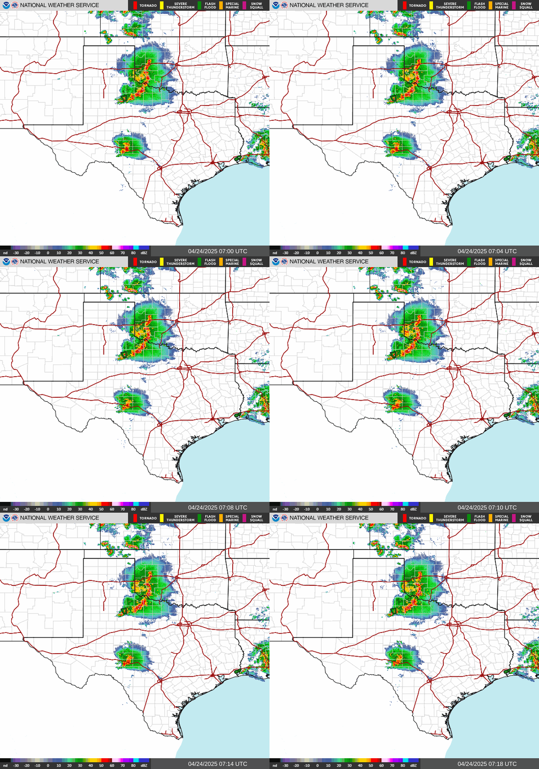

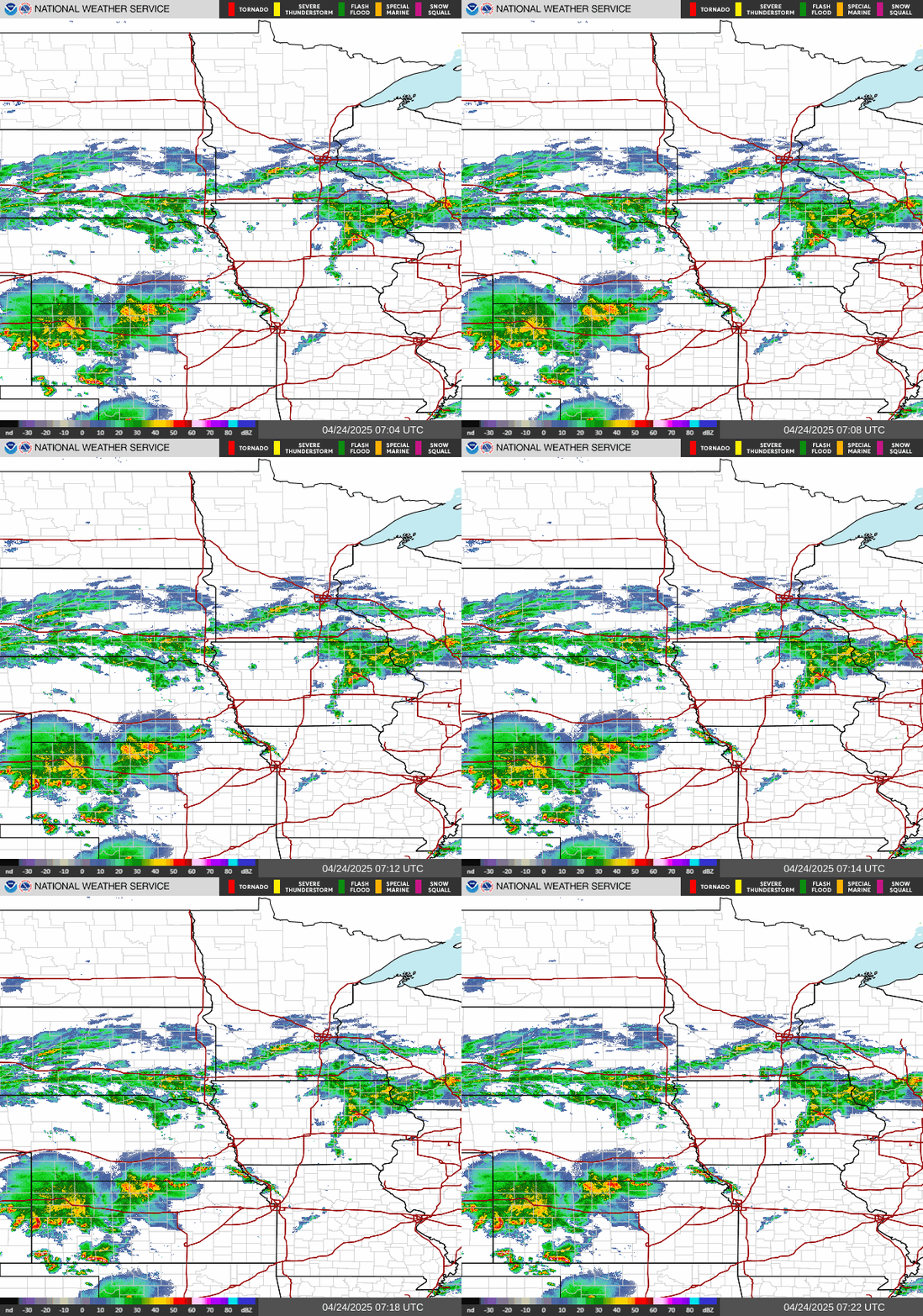


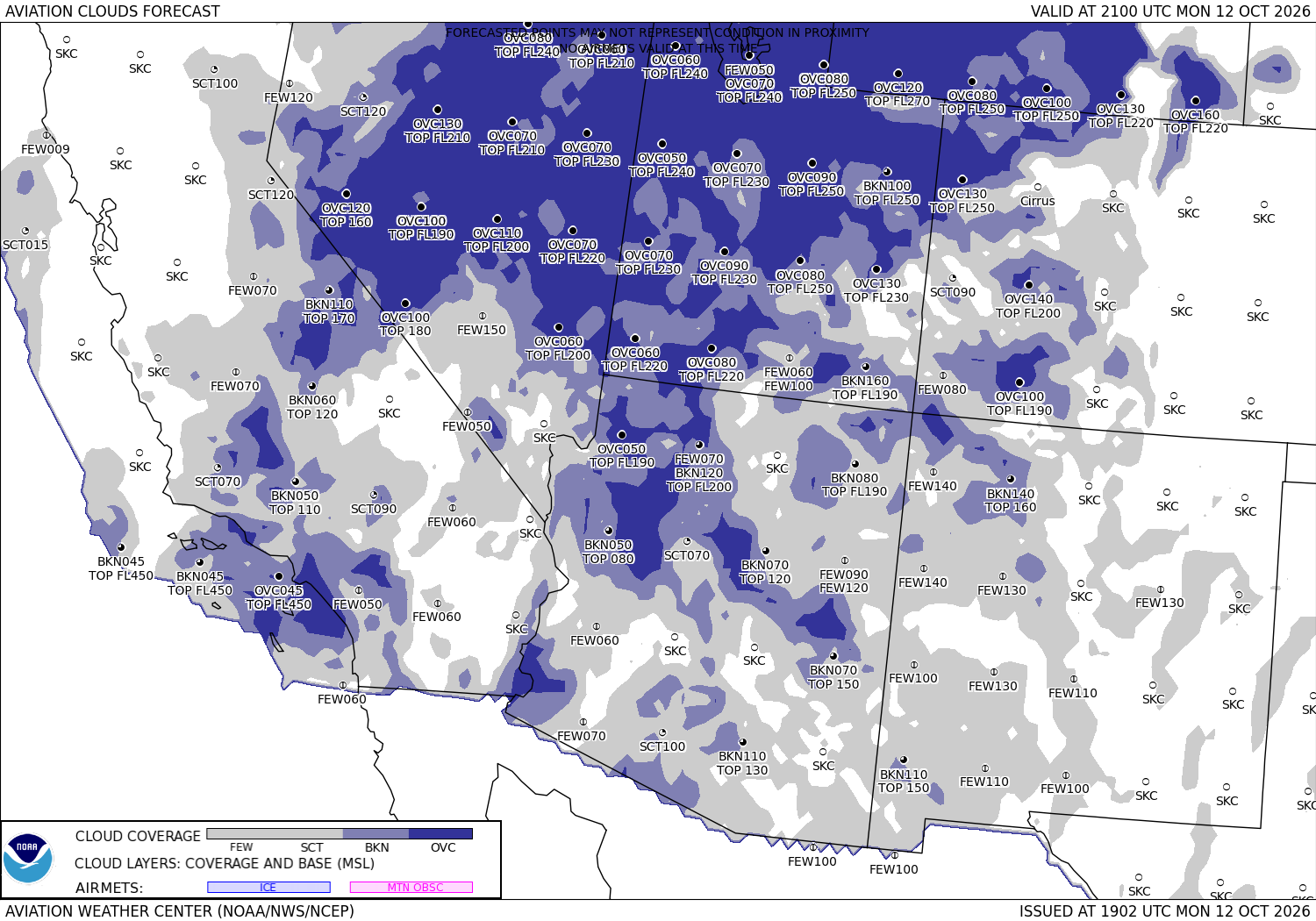
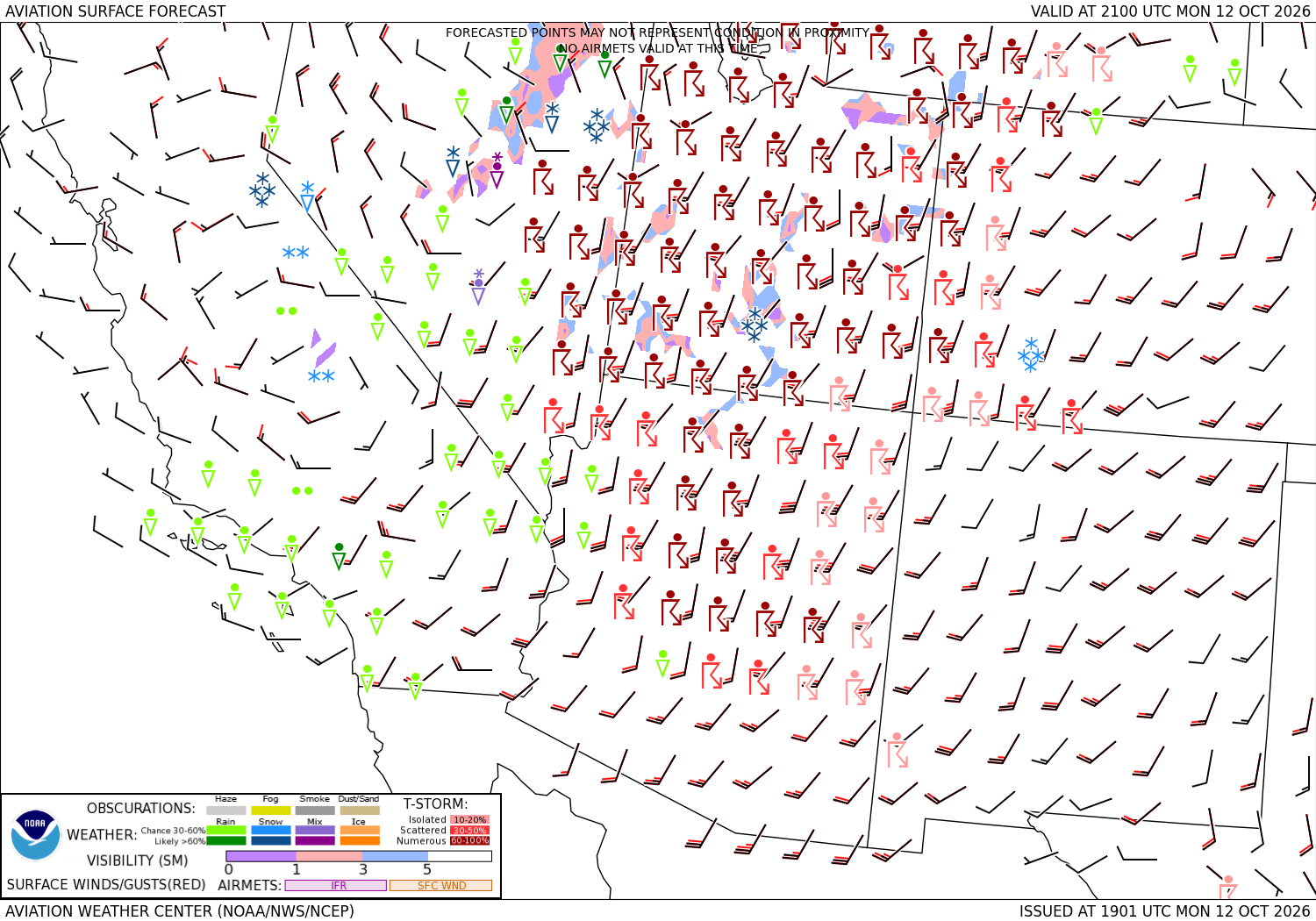
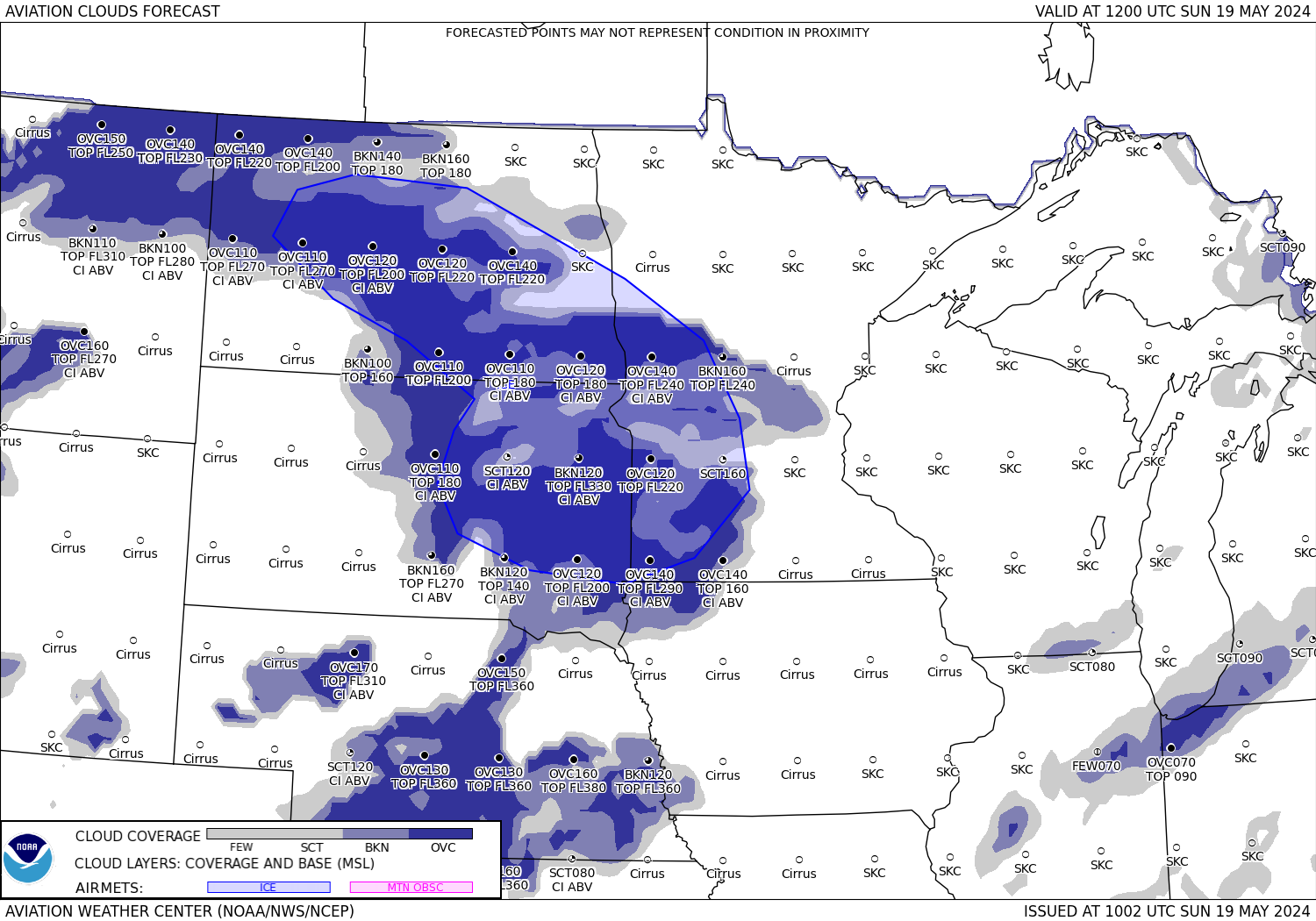
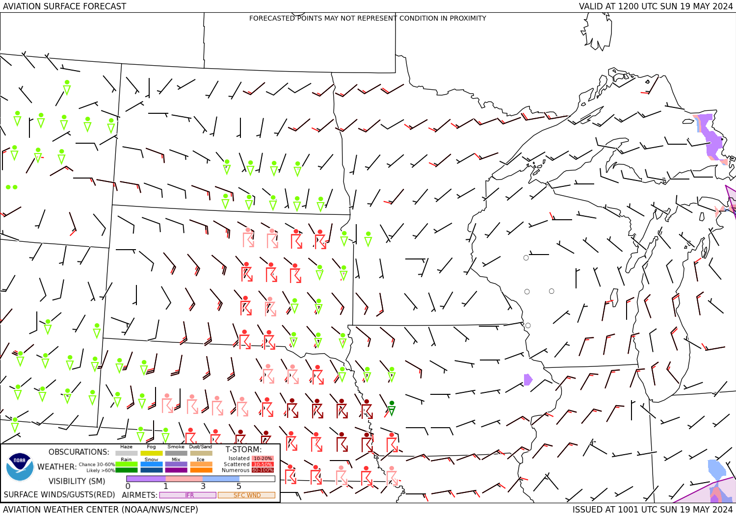




Sources: the Aviation Weather Center's data service (SIGMETs, AIRMETs, graphical AIRMETs, pilot reports, winds and temperatures aloft, observations and terminal forecasts), the National Weather Service radar, the Weather Prediction Center's charts, the FAA's temporary flight restriction list and shapes, and the FAA's airport file for the positions, elevations and magnetic variation. Fetched when the page is viewed and kept a few minutes. Each leg is the straight line between its two airports; airways, terrain and airspace are not considered. The airports in detail: EL Paso International, Chicago O'Hare International.