
San Antonio International to Norfolk International SAT → ORF
1,199 nautical miles (1,380 statute miles) northeast on a straight line, true course 063°, about 059° magnetic at the departure end (variation 4E). At 120 knots that is 9 h 13 min at the quickest height in today's winds (24,000 ft, a 10-knot tailwind), arriving about 10:27 pm EDT (02:27 UTC), after sunset at the destination. Right now SAT is VFR, wind from the south (170°) at 13 knots, gusting to 20; ORF is VFR, wind from the west-southwest (240°) at 7 knots. For planning, not a briefing: the legal preflight briefing comes from Flight Service (1-800-WX-BRIEF) or the FAA's own tools. Airlines fly this pair: 2 flights in the DOT's last twelve reported months, the route's page.
The route the straight line, the warnings crossed, restrictions, pilot reports and the airports along the way · click a mark for its words
Green, blue, red and purple airport dots are the flying conditions reported there now (VFR, marginal VFR, IFR, low IFR); grey means no report. Red areas are SIGMETs, orange areas AIRMETs, hatched red areas temporary flight restrictions. Map tiles: OpenFreeMap, data © OpenStreetMap contributors.
Warnings the route crosses SIGMETs and AIRMETs whose area the line passes through or comes within 25 nm of
- SIGMET C39C: thunderstorms (a convective SIGMET), until 1:55 pm CDT (18:55 UTC). Near the route, 170 nm along the route.
as issued
WSUS32 KKCI 131655
MKCC WST 131655
CONVECTIVE SIGMET 39C
VALID UNTIL 1855Z
LA TX
FROM 50W AEX-10ESE LCH-20SE IAH-40N IAH-50W AEX
AREA TS MOV FROM LTL. TOPS TO FL410.
Turbulence No turbulence warning in force along the route. 4 pilot reports of turbulence near the line in the last three hours: moderate clear-air turbulence, at 26,000 ft, 35 nm north, 9:19 am CDT (14:19 UTC); moderate turbulence above 26,000 ft, 29 nm north, 9:43 am CDT (14:43 UTC). The government's turbulence forecast map ↗
Icing No icing warning in force along the route. No pilot has reported icing near the line in the last three hours. The freezing level is about 15,000 ft (from the winds-aloft temperatures), so icing is possible in cloud above that. The government's icing forecast map ↗
A SIGMET warns of weather hazardous to all aircraft; an AIRMET of weather that matters to small aircraft and to flying without instruments. "From 60 to 180 nm out" is measured along the route from SAT.
Pilot reports along the route within 50 nm of the line, last three hours, the serious ones first
- A320 at 26,000 ft, 35 nm north, 9:19 am CDT (14:19 UTC): moderate clear-air turbulence, remarks: ZTLFD-42. 859 nm along the route, 35 nm north of the line.
as filed, and in English
AVL UA /OV SOT/TM 1419/FL260/TP A320/TB MOD CAT/RM ZTLFD-42
- Report
- a routine report filed through AVL
- Where
- over SOT
- Time
- 14:19 UTC
- Height
- at 26,000 ft
- Aircraft
- A320
- Turbulence
- moderate clear-air turbulence
- Remarks
- ZTLFD-42
- CRJ2 at 26,000 ft, 29 nm north, 9:43 am CDT (14:43 UTC): moderate turbulence above 26,000 ft, remarks: smooth at 28,000 ft ZTLFD-42. 899 nm along the route, 29 nm north of the line.
as filed, and in English
AVL UA /OV SUG360030/TM 1443/FL260/TP CRJ2/TB MOD 260/RM SMOOTH 280 ZTLFD-42
- Report
- a routine report filed through AVL
- Where
- 30 nm north (360°) of SUG
- Time
- 14:43 UTC
- Height
- at 26,000 ft
- Aircraft
- CRJ2
- Turbulence
- moderate at 26,000 ft
- Remarks
- smooth at 28,000 ft ZTLFD-42
- DA40 at 5,000 ft, 31 nm south, 11:09 am CDT (16:09 UTC): a broken layer up to 4,500 ft. At the departure end, 31 nm south of the line.
as filed, and in English
SAT UA /OV 15 S SSF/TM 1609/FL050/TP DA40/SK TOPS BKN045
- Report
- a routine report filed through SAT
- Where
- 15 south ssf
- Time
- 16:09 UTC
- Height
- at 5,000 ft
- Aircraft
- DA40
- Sky
- tops BKN045
- PA44 at 4,500 ft, 20 nm south, 10:37 am CDT (15:37 UTC): a broken layer up to 4,000 ft. At the departure end, 20 nm south of the line.
as filed, and in English
SAT UA /OV 3 S SSF/TM 1537/FL045/TP PA44/SK TOPS BKN040
- Report
- a routine report filed through SAT
- Where
- 3 south ssf
- Time
- 15:37 UTC
- Height
- at 4,500 ft
- Aircraft
- PA44
- Sky
- tops BKN040
- C150 at 3,900 ft, 42 nm northwest, 9:30 am CDT (14:30 UTC): remarks: zhu. At the departure end, 42 nm northwest of the line.
as filed, and in English
ERV UA /OV KERV/TM 1430/FL039/TP C150/SK BASE 039/RM ZHU
- Report
- a routine report filed through ERV
- Where
- over KERV
- Time
- 14:30 UTC
- Height
- at 3,900 ft
- Aircraft
- C150
- Sky
- base 3,900 ft
- Remarks
- zhu
- B38M at 6,000 ft, 4 nm west, 12:03 pm CDT (17:03 UTC): a routine report with nothing remarked on. At the departure end, 4 nm west of the line.
as filed, and in English
SAT UA /OV 5 E SAT/TM 1703/FL060/TP B38M/SK B-031, T-056
- Report
- a routine report filed through SAT
- Where
- 5 east sat
- Time
- 17:03 UTC
- Height
- at 6,000 ft
- Aircraft
- B38M
- Sky
- B-031, T-056
- C525 at 2,000 ft, 5 nm east, 9:47 am CDT (14:47 UTC): a broken layer above 2,000 ft. At the departure end, 5 nm east of the line.
as filed, and in English
BAZ UA /OV 4N/TM 1447/FL020/TP C525/SK BKN020
- Report
- a routine report filed through BAZ
- Where
- 4N
- Time
- 14:47 UTC
- Height
- at 2,000 ft
- Aircraft
- C525
- Sky
- a broken layer from 2,000 ft
- BE9L at 1,600 ft, 5 nm east, 9:22 am CDT (14:22 UTC): a broken layer above 1,600 ft. At the departure end, 5 nm east of the line.
as filed, and in English
BAZ UA /OV 2N/TM 1422/FL016/TP BE9L/SK BKN016
- Report
- a routine report filed through BAZ
- Where
- 2N
- Time
- 14:22 UTC
- Height
- at 1,600 ft
- Aircraft
- BE9L
- Sky
- a broken layer from 1,600 ft
- B737 at 2,200 ft, 17 nm northwest, 9:42 am CDT (14:42 UTC): a routine report with nothing remarked on. 60 nm along the route, 17 nm northwest of the line.
as filed, and in English
AUS UA /OV AUS/TM 1442/FL022/TP B737/WX OVC022
- Report
- a routine report filed through AUS
- Where
- over AUS
- Time
- 14:42 UTC
- Height
- at 2,200 ft
- Aircraft
- B737
- Weather
- OVC022
- B738 at 34,000 ft, 17 nm northwest, 9:27 am CDT (14:27 UTC): no turbulence, remarks: zhu. 60 nm along the route, 17 nm northwest of the line.
as filed, and in English
AUS UA /OV KCWK30015/TM 1427/FL340/TP B738/TB NEG/RM ZHU
- Report
- a routine report filed through AUS
- Where
- KCWK30015
- Time
- 14:27 UTC
- Height
- at 34,000 ft
- Aircraft
- B738
- Turbulence
- none
- Remarks
- zhu
- A321 at 1,700 ft, 17 nm northwest, 9:25 am CDT (14:25 UTC): a routine report with nothing remarked on. 60 nm along the route, 17 nm northwest of the line.
as filed, and in English
AUS UA /OV AUS/TM 1425/FL017/TP A321/WX OVC 017
- Report
- a routine report filed through AUS
- Where
- over AUS
- Time
- 14:25 UTC
- Height
- at 1,700 ft
- Aircraft
- A321
- Weather
- overcast, at 1,700 ft
- A321 at 3,500 ft, 24 nm northwest, 9:22 am CDT (14:22 UTC): a broken layer. 60 nm along the route, 24 nm northwest of the line.
as filed, and in English
AUS UA /OV 9N AUS/TM 1422/FL035/TP A321/SK BKN/WX TOPS 035
- Report
- a routine report filed through AUS
- Where
- 9N aus
- Time
- 14:22 UTC
- Height
- at 3,500 ft
- Aircraft
- A321
- Sky
- a broken layer
- Weather
- tops, at 3,500 ft
- H85B at 3,000 ft, 12 nm southeast, 11:52 am CDT (16:52 UTC): a routine report with nothing remarked on. 110 nm along the route, 12 nm southeast of the line.
as filed, and in English
CLL UA /OV 3 W 11R/TM 1652/FL030/TP H85B/SK BASES 024
- Report
- a routine report filed through CLL
- Where
- 3 west 11R
- Time
- 16:52 UTC
- Height
- at 3,000 ft
- Aircraft
- H85B
- Sky
- bases 2,400 ft
- GLEX at 23,000 ft, 11 nm south, 11:26 am CDT (16:26 UTC): remarks: zhu. 120 nm along the route, 11 nm south of the line.
as filed, and in English
CLL UA /OV KCLL180020/TM 1626/FL230/TP GLEX/SK 230 TOP/RM ZHU
- Report
- a routine report filed through CLL
- Where
- 20 nm south (180°) of KCLL
- Time
- 16:26 UTC
- Height
- at 23,000 ft
- Aircraft
- GLEX
- Sky
- at 23,000 ft top
- Remarks
- zhu
16 more routine reports are on the map.
Winds aloft along the route, and the time en route the forecast for use 14:00–21:00 UTC · at 120 knots true airspeed
The eastbound cruising heights for this course (VFR: odd thousands plus 500 ft; above 18,000 ft the forecast levels), with the wind averaged along the line from the 12 forecast points nearest it (SAT, CLL, SHV, JAN, BHM, HSV, ATL, TYS, GSP, RDU, RIC, ORF). A plus sign is a headwind, a minus sign a tailwind.
| Height | Average wind | Head- or tailwind | Temperature | Ground speed | Time en route | Arrival |
|---|---|---|---|---|---|---|
| 3,500 ft | 220° at 6 kt | −6 kt | 126 kt | 9 h 31 min | 10:45 pm EDT (02:45 UTC) | |
| 5,500 ft | 240° at 7 kt | −7 kt | 127 kt | 9 h 26 min | 10:40 pm EDT (02:40 UTC) | |
| 7,500 ft | 260° at 8 kt | −8 kt | 14 °C | 128 kt | 9 h 22 min | 10:36 pm EDT (02:36 UTC) |
| 9,500 ft | 270° at 8 kt | −8 kt | 11 °C | 128 kt | 9 h 22 min | 10:36 pm EDT (02:36 UTC) |
| 11,500 ft | 290° at 7 kt | −5 kt | 9 °C | 125 kt | 9 h 36 min | 10:50 pm EDT (02:50 UTC) |
| 13,500 ft | 300° at 8 kt | −6 kt | 4 °C | 126 kt | 9 h 31 min | 10:45 pm EDT (02:45 UTC) |
| 15,500 ft | 300° at 11 kt | −7 kt | -1 °C | 127 kt | 9 h 26 min | 10:40 pm EDT (02:40 UTC) |
| 17,500 ft | 300° at 13 kt | −8 kt | -6 °C | 128 kt | 9 h 22 min | 10:36 pm EDT (02:36 UTC) |
| 18,000 ft FL180 | 300° at 14 kt | −8 kt | -7 °C | 128 kt | 9 h 22 min | 10:36 pm EDT (02:36 UTC) |
| 24,000 ft FL240 | 310° at 19 kt | −10 kt | -17 °C | 130 kt | 9 h 13 min | 10:27 pm EDT (02:27 UTC) |
| 30,000 ft FL300 | 330° at 25 kt | −4 kt | -29 °C | 124 kt | 9 h 40 min | 10:54 pm EDT (02:54 UTC) |
| 34,000 ft FL340 | 340° at 27 kt | +1 kt | -39 °C | 119 kt | 10 h 05 min | 11:19 pm EDT (03:19 UTC) |
| 39,000 ft FL390 | 350° at 24 kt | +4 kt | -49 °C | 116 kt | 10 h 20 min | 11:34 pm EDT (03:34 UTC) |
Based on data from the 13th at 12:00 UTC; valid on the 13th at 18:00 UTC for use 14:00 to 21:00 UTC; temperatures above 24,000 ft are below zero. Heights are above sea level; a height is left out when the forecast has no wind for it over most of the line (the ground is higher). Ground speed is the airspeed less the headwind; the time en route is for the straight line and ignores climb, descent and routing around weather.
The forecast points as issued
| Point | From | 3,000 | 6,000 | 9,000 | 12,000 | 18,000 | 24,000 | 30,000 | 34,000 | 39,000 |
|---|---|---|---|---|---|---|---|---|---|---|
| SAT | used from 0 nm out; 25 nm from the line | 160/17 | 180/23 19° | 190/17 16° | 170/12 11° | 160/14 -5° | 230/14 -15° | 160/19 -29° | 150/24 -40° | 140/34 -51° |
| CLL | used from 50 nm out; 52 nm from the line | 180/15 | 190/18 18° | 210/15 15° | 180/8 10° | 250/14 -5° | 250/14 -14° | 200/18 -29° | 170/21 -39° | 150/29 -50° |
| SHV | used from 200 nm out; 84 nm from the line | 210/11 | 230/15 17° | 200/13 13° | 220/12 8° | 250/19 -5° | 260/13 -14° | 250/23 -29° | 230/11 -38° | 260/5 -50° |
| JAN | used from 350 nm out; 94 nm from the line | 210/8 | 270/9 16° | L/V 12° | L/V 8° | 330/10 -6° | 320/21 -14° | 350/19 -29° | 350/22 -39° | 020/19 -50° |
| BHM | used from 550 nm out; 76 nm from the line | 280/7 | 270/8 17° | 270/10 12° | 300/16 7° | 340/23 -7° | 330/38 -15° | 350/45 -28° | 350/41 -39° | 350/38 -50° |
| HSV | used from 650 nm out; 33 nm from the line | 270/10 | 250/9 16° | 270/11 12° | 300/17 7° | 330/23 -7° | 330/34 -16° | 340/47 -28° | 340/41 -38° | 340/40 -50° |
| ATL | used from 749 nm out; 67 nm from the line | 330/6 | 360/7 15° | 320/14 11° | 320/19 6° | 320/20 -7° | 350/27 -18° | 350/55 -28° | 350/48 -38° | 360/48 -50° |
| TYS | used from 799 nm out; 51 nm from the line | 260/10 | 290/8 15° | 290/19 10° | 310/13 7° | 310/19 -8° | 330/25 -19° | 340/55 -28° | 340/53 -38° | 350/57 -49° |
| GSP | used from 849 nm out; 31 nm from the line | L/V | 340/9 14° | 310/15 10° | 330/13 7° | 320/21 -8° | 300/17 -21° | 340/42 -28° | 350/58 -37° | 350/56 -48° |
| RDU | used from 949 nm out; 91 nm from the line | L/V | 310/7 14° | 310/15 10° | 340/16 6° | 310/18 -8° | 300/25 -21° | 340/41 -30° | 350/56 -39° | 350/58 -47° |
| RIC | used from 1099 nm out; 60 nm from the line | 230/12 | 280/13 14° | 300/21 10° | 340/11 6° | 310/20 -9° | 290/23 -21° | 330/41 -32° | 340/55 -40° | 330/51 -48° |
| ORF | used from 1149 nm out; 25 nm from the line | 230/8 | 280/8 15° | 300/12 10° | 300/6 5° | 310/17 -8° | 310/22 -21° | 320/36 -34° | 340/50 -40° | 310/35 -46° |
The weather now: both ends and the airports along the way public airports with a weather report within 25 nm of the line, one for each stretch
| Airport | Where | Conditions | Wind | Visibility | Ceiling | Elevation | Reported |
|---|---|---|---|---|---|---|---|
| SAT San Antonio, TX | departure | VFR Sky: scattered clouds at 3,000 feet, a broken layer at 3,800 feet, a broken layer at 23,000 feet | from the south (170°) at 13 knots, gusting to 20 | 10+ mi | 3,800 ft | 809 ft | 11:51 am CDT (16:51 UTC) |
| BAZ New Braunfels, TX | 20 nm out, 5 nm east of the line, tower | VFR Sky: scattered clouds at 3,300 feet | from the south (170°) at 13 knots, gusting to 19 | 10+ mi | none | 658 ft | 16:51 UTC |
| CLL College Station, TX | 130 nm out, 8 nm northwest of the line, tower | VFR Sky: a few clouds at 2,500 feet | from the south (180°) at 10 knots | 10+ mi | none | 320 ft | 16:53 UTC |
| IER Natchitoches, LA | 310 nm out, 4 nm south of the line | marginal VFR Sky: a broken layer at 2,000 feet, a broken layer at 3,700 feet, overcast at 4,400 feet | calm | 10+ mi | 2,000 ft | 121 ft | 16:55 UTC |
| MLU Monroe, LA | 380 nm out, 17 nm northwest of the line, tower | VFR Sky: scattered clouds at 2,800 feet, a broken layer at 3,400 feet, a broken layer at 7,000 feet | from the southwest (230°) at 5 knots | 10+ mi | 3,400 ft | 78 ft | 17:09 UTC |
| GTR Columbus/W Point/Starkville, MS | 560 nm out, 2 nm southwest of the line, tower | VFR | variable at 4 knots | 10+ mi | none | 264 ft | 16:56 UTC |
| JFX Jasper, AL | 630 nm out, 3 nm west of the line | VFR | calm | 10+ mi | none | 482 ft | 16:55 UTC |
| DZJ Blairsville, GA | 799 nm out, 3 nm southeast of the line | VFR | from the north (360°) at 4 knots | 10+ mi | none | 1,906 ft | 16:55 UTC |
| AVL Asheville, NC | 879 nm out, 6 nm north of the line, tower | VFR | variable at 3 knots | 10+ mi | none | 2,163 ft | 16:54 UTC |
| GSO Greensboro, NC | 1009 nm out, 6 nm north of the line, tower | VFR Sky: a few clouds at 25,000 feet | variable at 3 knots | 10+ mi | none | 925 ft | 16:54 UTC |
| EMV Emporia, VA | 1139 nm out, 5 nm northwest of the line | VFR | from the south (170°) at 5 knots | 10+ mi | none | 126 ft | 16:55 UTC |
| ORF Norfolk, VA | destination | VFR | from the west-southwest (240°) at 7 knots | 10+ mi | none | 26 ft | 12:51 pm EDT (16:51 UTC) |
The highest airport on this list sits at 2,163 ft; the ground between airports is higher still. Check the sectional chart for the terrain and the minimum safe heights along the line.
The codes as issued, and in English, for every airport in the table
SAT San Antonio, TX
the observation and the forecast as issued, and in English
METAR KSAT 131651Z 17013G20KT 10SM SCT030 BKN038 BKN230 31/22 A3000 RMK AO2 SLP140 T03060222
- METAR
- a routine hourly observation
- KSAT
- the station, KSAT
- 131651Z
- observed 11:51 am CDT (16:51 UTC)
- 17013G20KT
- wind from the south at 13 knots, gusting to 20
- 10SM
- visibility 10 miles
- SCT030
- scattered clouds at 3,000 feet
- BKN038
- a broken layer at 3,800 feet
- BKN230
- a broken layer at 23,000 feet
- 31/22
- temperature 31 °C (88 °F), dew point 22 °C (72 °F)
- A3000
- altimeter setting 30.00 inches of mercury
- RMK
- remarks follow
- AO2
- automated station with a precipitation sensor
- SLP140
- sea-level pressure 1014.0 hPa
- T03060222
- temperature 30.6 °C (87 °F), dew point 22.2 °C (72 °F)
TAF KSAT 131449Z 1315/1418 17011KT P6SM BKN015 FM131600 17013KT P6SM BKN022 FM131700 15015G25KT P6SM SCT050 FM140500 15012KT P6SM BKN022 FM140600 15010KT P6SM OVC012 FM141700 16013KT P6SM BKN030
- TAF
- a terminal aerodrome forecast: the weather expected at the airport, usually for the next 24 or 30 hours
- KSAT
- the station, KSAT
- 131449Z
- issued 9:49 am CDT (14:49 UTC)
- 1315/1418 17011KT P6SM BKN015
- valid from Tue 10:00 am CDT (15:00 UTC) to Wed 1:00 pm CDT (18:00 UTC): wind from the south at 11 knots, visibility more than 6 miles, a broken layer at 1,500 feet
- FM131600 17013KT P6SM BKN022
- from Tue 11:00 am CDT (16:00 UTC): wind from the south at 13 knots, visibility more than 6 miles, a broken layer at 2,200 feet
- FM131700 15015G25KT P6SM SCT050
- from Tue 12:00 pm CDT (17:00 UTC): wind from the south-southeast at 15 knots, gusting to 25, visibility more than 6 miles, scattered clouds at 5,000 feet
- FM140500 15012KT P6SM BKN022
- from Wed 12:00 am CDT (05:00 UTC): wind from the south-southeast at 12 knots, visibility more than 6 miles, a broken layer at 2,200 feet
- FM140600 15010KT P6SM OVC012
- from Wed 1:00 am CDT (06:00 UTC): wind from the south-southeast at 10 knots, visibility more than 6 miles, overcast at 1,200 feet
- FM141700 16013KT P6SM BKN030
- from Wed 12:00 pm CDT (17:00 UTC): wind from the south-southeast at 13 knots, visibility more than 6 miles, a broken layer at 3,000 feet
BAZ New Braunfels, TX
the observation as issued, and in English
METAR KBAZ 131651Z 17013G19KT 10SM SCT033 32/23 A2999 RMK AO2 SLP145 T03170228
- METAR
- a routine hourly observation
- KBAZ
- the station, KBAZ
- 131651Z
- observed 16:51 UTC on the 13th
- 17013G19KT
- wind from the south at 13 knots, gusting to 19
- 10SM
- visibility 10 miles
- SCT033
- scattered clouds at 3,300 feet
- 32/23
- temperature 32 °C (90 °F), dew point 23 °C (73 °F)
- A2999
- altimeter setting 29.99 inches of mercury
- RMK
- remarks follow
- AO2
- automated station with a precipitation sensor
- SLP145
- sea-level pressure 1014.5 hPa
- T03170228
- temperature 31.7 °C (89 °F), dew point 22.8 °C (73 °F)
CLL College Station, TX
the observation and the forecast as issued, and in English
METAR KCLL 131653Z 18010KT 10SM FEW025 30/24 A3001 RMK AO2 SLP157 T03000244
- METAR
- a routine hourly observation
- KCLL
- the station, KCLL
- 131653Z
- observed 16:53 UTC on the 13th
- 18010KT
- wind from the south at 10 knots
- 10SM
- visibility 10 miles
- FEW025
- a few clouds at 2,500 feet
- 30/24
- temperature 30 °C (86 °F), dew point 24 °C (75 °F)
- A3001
- altimeter setting 30.01 inches of mercury
- RMK
- remarks follow
- AO2
- automated station with a precipitation sensor
- SLP157
- sea-level pressure 1015.7 hPa
- T03000244
- temperature 30 °C (86 °F), dew point 24.4 °C (76 °F)
TAF KCLL 131120Z 1312/1412 16007KT P6SM SCT007 BKN015 TEMPO 1312/1313 OVC007 FM131600 16010G19KT P6SM SCT025 BKN035 FM140000 14010KT P6SM BKN250 FM140600 15005KT P6SM FEW009 BKN020
- TAF
- a terminal aerodrome forecast: the weather expected at the airport, usually for the next 24 or 30 hours
- KCLL
- the station, KCLL
- 131120Z
- issued 11:20 UTC on the 13th
- 1312/1412 16007KT P6SM SCT007 BKN015
- valid from Tue 12:00 UTC to Wed 12:00 UTC: wind from the south-southeast at 7 knots, visibility more than 6 miles, scattered clouds at 700 feet, a broken layer at 1,500 feet
- TEMPO 1312/1313 OVC007
- at times from Tue 12:00 UTC to Tue 13:00 UTC: overcast at 700 feet
- FM131600 16010G19KT P6SM SCT025 BKN035
- from Tue 16:00 UTC: wind from the south-southeast at 10 knots, gusting to 19, visibility more than 6 miles, scattered clouds at 2,500 feet, a broken layer at 3,500 feet
- FM140000 14010KT P6SM BKN250
- from Wed 00:00 UTC: wind from the southeast at 10 knots, visibility more than 6 miles, a broken layer at 25,000 feet
- FM140600 15005KT P6SM FEW009 BKN020
- from Wed 06:00 UTC: wind from the south-southeast at 5 knots, visibility more than 6 miles, a few clouds at 900 feet, a broken layer at 2,000 feet
IER Natchitoches, LA
the observation as issued, and in English
METAR KIER 131655Z AUTO 00000KT 10SM BKN020 BKN037 OVC044 29/24 A3007 RMK AO2 T02920242
- METAR
- a routine hourly observation
- KIER
- the station, KIER
- 131655Z
- observed 16:55 UTC on the 13th
- AUTO
- fully automated report, nobody checked it
- 00000KT
- wind calm
- 10SM
- visibility 10 miles
- BKN020
- a broken layer at 2,000 feet
- BKN037
- a broken layer at 3,700 feet
- OVC044
- overcast at 4,400 feet
- 29/24
- temperature 29 °C (84 °F), dew point 24 °C (75 °F)
- A3007
- altimeter setting 30.07 inches of mercury
- RMK
- remarks follow
- AO2
- automated station with a precipitation sensor
- T02920242
- temperature 29.2 °C (85 °F), dew point 24.2 °C (76 °F)
MLU Monroe, LA
the observation and the forecast as issued, and in English
SPECI KMLU 131709Z 23005KT 10SM SCT028 BKN034 BKN070 31/24 A3007 RMK AO2 T03060239
- SPECI
- a special observation, issued because the weather changed
- KMLU
- the station, KMLU
- 131709Z
- observed 17:09 UTC on the 13th
- 23005KT
- wind from the southwest at 5 knots
- 10SM
- visibility 10 miles
- SCT028
- scattered clouds at 2,800 feet
- BKN034
- a broken layer at 3,400 feet
- BKN070
- a broken layer at 7,000 feet
- 31/24
- temperature 31 °C (88 °F), dew point 24 °C (75 °F)
- A3007
- altimeter setting 30.07 inches of mercury
- RMK
- remarks follow
- AO2
- automated station with a precipitation sensor
- T03060239
- temperature 30.6 °C (87 °F), dew point 23.9 °C (75 °F)
TAF KMLU 131602Z 1316/1412 20009KT P6SM FEW020 FM131800 21007KT P6SM VCTS SCT050CB SCT250 FM140600 VRB03KT P6SM SCT100
- TAF
- a terminal aerodrome forecast: the weather expected at the airport, usually for the next 24 or 30 hours
- KMLU
- the station, KMLU
- 131602Z
- issued 16:02 UTC on the 13th
- 1316/1412 20009KT P6SM FEW020
- valid from Tue 16:00 UTC to Wed 12:00 UTC: wind from the south-southwest at 9 knots, visibility more than 6 miles, a few clouds at 2,000 feet
- FM131800 21007KT P6SM VCTS SCT050CB SCT250
- from Tue 18:00 UTC: wind from the south-southwest at 7 knots, visibility more than 6 miles, vcts, scattered clouds at 5,000 feet (thunderheads), scattered clouds at 25,000 feet
- FM140600 VRB03KT P6SM SCT100
- from Wed 06:00 UTC: wind light and variable, visibility more than 6 miles, scattered clouds at 10,000 feet
GTR Columbus/W Point/Starkville, MS
the observation and the forecast as issued, and in English
METAR KGTR 131656Z VRB04KT 10SM CLR 31/21 A3012 RMK AO2 SLP197 T03060206 $
- METAR
- a routine hourly observation
- KGTR
- the station, KGTR
- 131656Z
- observed 16:56 UTC on the 13th
- VRB04KT
- wind light and variable
- 10SM
- visibility 10 miles
- CLR
- clear skies
- 31/21
- temperature 31 °C (88 °F), dew point 21 °C (70 °F)
- A3012
- altimeter setting 30.12 inches of mercury
- RMK
- remarks follow
- AO2
- automated station with a precipitation sensor
- SLP197
- sea-level pressure 1019.7 hPa
- T03060206
- temperature 30.6 °C (87 °F), dew point 20.6 °C (69 °F)
- $
- the station needs maintenance
TAF KGTR 131120Z 1312/1412 19004KT P6SM SKC
- TAF
- a terminal aerodrome forecast: the weather expected at the airport, usually for the next 24 or 30 hours
- KGTR
- the station, KGTR
- 131120Z
- issued 11:20 UTC on the 13th
- 1312/1412 19004KT P6SM SKC
- valid from Tue 12:00 UTC to Wed 12:00 UTC: wind from the south at 4 knots, visibility more than 6 miles, clear skies
JFX Jasper, AL
the observation as issued, and in English
METAR KJFX 131655Z AUTO 00000KT 10SM CLR 28/21 A3014 RMK AO2
- METAR
- a routine hourly observation
- KJFX
- the station, KJFX
- 131655Z
- observed 16:55 UTC on the 13th
- AUTO
- fully automated report, nobody checked it
- 00000KT
- wind calm
- 10SM
- visibility 10 miles
- CLR
- clear skies
- 28/21
- temperature 28 °C (82 °F), dew point 21 °C (70 °F)
- A3014
- altimeter setting 30.14 inches of mercury
- RMK
- remarks follow
- AO2
- automated station with a precipitation sensor
DZJ Blairsville, GA
the observation as issued, and in English
METAR KDZJ 131655Z AUTO 36004KT 10SM CLR 26/15 A3020 RMK AO2 T02620147
- METAR
- a routine hourly observation
- KDZJ
- the station, KDZJ
- 131655Z
- observed 16:55 UTC on the 13th
- AUTO
- fully automated report, nobody checked it
- 36004KT
- wind from the north at 4 knots
- 10SM
- visibility 10 miles
- CLR
- clear skies
- 26/15
- temperature 26 °C (79 °F), dew point 15 °C (59 °F)
- A3020
- altimeter setting 30.20 inches of mercury
- RMK
- remarks follow
- AO2
- automated station with a precipitation sensor
- T02620147
- temperature 26.2 °C (79 °F), dew point 14.7 °C (58 °F)
AVL Asheville, NC
the observation and the forecast as issued, and in English
METAR KAVL 131654Z VRB03KT 10SM CLR 25/14 A3018 RMK AO1 SLP201 T02500139
- METAR
- a routine hourly observation
- KAVL
- the station, KAVL
- 131654Z
- observed 16:54 UTC on the 13th
- VRB03KT
- wind light and variable
- 10SM
- visibility 10 miles
- CLR
- clear skies
- 25/14
- temperature 25 °C (77 °F), dew point 14 °C (57 °F)
- A3018
- altimeter setting 30.18 inches of mercury
- RMK
- remarks follow
- AO1
- automated station without a precipitation sensor (it cannot tell rain from snow)
- SLP201
- sea-level pressure 1020.1 hPa
- T02500139
- temperature 25 °C (77 °F), dew point 13.9 °C (57 °F)
TAF KAVL 131121Z 1312/1412 33005KT P6SM SKC FM131600 34004KT P6SM FEW050 FM140100 00000KT P6SM SKC
- TAF
- a terminal aerodrome forecast: the weather expected at the airport, usually for the next 24 or 30 hours
- KAVL
- the station, KAVL
- 131121Z
- issued 11:21 UTC on the 13th
- 1312/1412 33005KT P6SM SKC
- valid from Tue 12:00 UTC to Wed 12:00 UTC: wind from the north-northwest at 5 knots, visibility more than 6 miles, clear skies
- FM131600 34004KT P6SM FEW050
- from Tue 16:00 UTC: wind from the north-northwest at 4 knots, visibility more than 6 miles, a few clouds at 5,000 feet
- FM140100 00000KT P6SM SKC
- from Wed 01:00 UTC: wind calm, visibility more than 6 miles, clear skies
GSO Greensboro, NC
the observation and the forecast as issued, and in English
METAR KGSO 131654Z VRB03KT 10SM FEW250 27/16 A3009 RMK AO2 SLP178 T02720161
- METAR
- a routine hourly observation
- KGSO
- the station, KGSO
- 131654Z
- observed 16:54 UTC on the 13th
- VRB03KT
- wind light and variable
- 10SM
- visibility 10 miles
- FEW250
- a few clouds at 25,000 feet
- 27/16
- temperature 27 °C (81 °F), dew point 16 °C (61 °F)
- A3009
- altimeter setting 30.09 inches of mercury
- RMK
- remarks follow
- AO2
- automated station with a precipitation sensor
- SLP178
- sea-level pressure 1017.8 hPa
- T02720161
- temperature 27.2 °C (81 °F), dew point 16.1 °C (61 °F)
TAF KGSO 131120Z 1312/1412 25005KT P6SM SCT250
- TAF
- a terminal aerodrome forecast: the weather expected at the airport, usually for the next 24 or 30 hours
- KGSO
- the station, KGSO
- 131120Z
- issued 11:20 UTC on the 13th
- 1312/1412 25005KT P6SM SCT250
- valid from Tue 12:00 UTC to Wed 12:00 UTC: wind from the west-southwest at 5 knots, visibility more than 6 miles, scattered clouds at 25,000 feet
EMV Emporia, VA
the observation as issued, and in English
METAR KEMV 131655Z AUTO 17005KT 10SM CLR 27/17 A3007 RMK AO2 T02650174
- METAR
- a routine hourly observation
- KEMV
- the station, KEMV
- 131655Z
- observed 16:55 UTC on the 13th
- AUTO
- fully automated report, nobody checked it
- 17005KT
- wind from the south at 5 knots
- 10SM
- visibility 10 miles
- CLR
- clear skies
- 27/17
- temperature 27 °C (81 °F), dew point 17 °C (63 °F)
- A3007
- altimeter setting 30.07 inches of mercury
- RMK
- remarks follow
- AO2
- automated station with a precipitation sensor
- T02650174
- temperature 26.5 °C (80 °F), dew point 17.4 °C (63 °F)
ORF Norfolk, VA
the observation and the forecast as issued, and in English
METAR KORF 131651Z 24007KT 10SM CLR 27/16 A3004 RMK AO2 SLP172 T02670161
- METAR
- a routine hourly observation
- KORF
- the station, KORF
- 131651Z
- observed 12:51 pm EDT (16:51 UTC)
- 24007KT
- wind from the west-southwest at 7 knots
- 10SM
- visibility 10 miles
- CLR
- clear skies
- 27/16
- temperature 27 °C (81 °F), dew point 16 °C (61 °F)
- A3004
- altimeter setting 30.04 inches of mercury
- RMK
- remarks follow
- AO2
- automated station with a precipitation sensor
- SLP172
- sea-level pressure 1017.2 hPa
- T02670161
- temperature 26.7 °C (80 °F), dew point 16.1 °C (61 °F)
TAF KORF 131120Z 1312/1412 VRB05KT P6SM SKC FM140400 21007KT P6SM SKC
- TAF
- a terminal aerodrome forecast: the weather expected at the airport, usually for the next 24 or 30 hours
- KORF
- the station, KORF
- 131120Z
- issued 7:20 am EDT (11:20 UTC)
- 1312/1412 VRB05KT P6SM SKC
- valid from Tue 8:00 am EDT (12:00 UTC) to Wed 8:00 am EDT (12:00 UTC): wind light and variable, visibility more than 6 miles, clear skies
- FM140400 21007KT P6SM SKC
- from Wed 12:00 am EDT (04:00 UTC): wind from the south-southwest at 7 knots, visibility more than 6 miles, clear skies
At ORF when you get there the forecast at the estimated arrival, 10:27 pm EDT (02:27 UTC)
Wind light and variable, visibility more than 6 miles, clear skies VFR
The whole forecast for ORF
- From Tue 8:00 am EDT (12:00 UTC): wind light and variable, visibility more than 6 miles, clear skies
- From Wed 12:00 am EDT (04:00 UTC): wind from the south-southwest at 7 knots, visibility more than 6 miles, clear skies
The forecast for SAT, the departure
- From Tue 10:00 am CDT (15:00 UTC): wind from the south at 11 knots, visibility more than 6 miles, a broken layer at 1,500 feet
- From Tue 11:00 am CDT (16:00 UTC): wind from the south at 13 knots, visibility more than 6 miles, a broken layer at 2,200 feet
- From Tue 12:00 pm CDT (17:00 UTC): wind from the south-southeast at 15 knots, gusting to 25, visibility more than 6 miles, scattered clouds at 5,000 feet
- From Wed 12:00 am CDT (05:00 UTC): wind from the south-southeast at 12 knots, visibility more than 6 miles, a broken layer at 2,200 feet
- From Wed 1:00 am CDT (06:00 UTC): wind from the south-southeast at 10 knots, visibility more than 6 miles, overcast at 1,200 feet
- From Wed 12:00 pm CDT (17:00 UTC): wind from the south-southeast at 13 knots, visibility more than 6 miles, a broken layer at 3,000 feet
ORF: the forecast as issued, and in English
TAF KORF 131120Z 1312/1412 VRB05KT P6SM SKC FM140400 21007KT P6SM SKC
SAT: the forecast as issued, and in English
TAF KSAT 131449Z 1315/1418 17011KT P6SM BKN015 FM131600 17013KT P6SM BKN022 FM131700 15015G25KT P6SM SCT050 FM140500 15012KT P6SM BKN022 FM140600 15010KT P6SM OVC012 FM141700 16013KT P6SM BKN030
Temporary flight restrictions on the line or within 25 nm of it
No temporary flight restriction on or near this route right now.
Notices to air missions closures and things out of service at both ends; airspace, navigation aids and obstructions near the line
SAT: 30 notices in force, 1 starting within a week. runway 04/22 closed all of them, grouped →
- closed Runway 04/22 closed until Tue 13 Oct, 4:00 pm CDT (21:00 UTC) · SAT 10/033
as issued
!SAT 10/033 SAT RWY 04/22 CLSD 2610131300-2610132100
- closed Taxiway T closed until Tue 13 Oct, 4:00 pm CDT (21:00 UTC) · SAT 10/035
as issued
!SAT 10/035 SAT TWY T CLSD 2610131300-2610132100
ORF: 33 notices in force, 3 starting within a week. all of them, grouped →
- closed Taxiway C between Terminal APN center Access and Terminal APN north Access closed except 30 minutes prior permission required 757-536-2793 Sundays-Fridays 12:00 am EDT to 5:00 am EDT until Fri 30 Oct, 5:00 am EDT (09:00 UTC) · Sundays Mondays Tuesdays Wednesdays Thursdays Fridays · ORF 10/014
as issued
!ORF 10/014 ORF TWY C BTN TERMINAL APN CENTER ACCESS AND TERMINAL APN NORTH ACCESS CLSD EXC 30MIN PPR 757-536-2793 SUN-FRI 0400-0900 2610040400-2610300900
Airports along the way: MLU runway 04/22 closed
386 notices near the line, the first 30 (airspace and special activity within 25 nm, navigation aids within 25 nm, obstructions within 5 nm):
- closed Security Instructions, Washington, DC. this Notam References the Washington DC special flight Rules area (Sfra) only and Excludes the Washington DC area speed Restrictions that are NOW located in A Separate Notam. this Notam Cancels flight data center 4/1734. A Separate Notam References the Washington DC flight restricted zone (FRZ) procedures and operations by unmanned aircraft systems (unmanned aircraft (drones)), including model aircraft (Hobbyist or Recreational unmanned aircraft (drones) only), civil and commercial operations, and public operations within the Sfra. special security Instructions for aircraft operations in the DC Sfra are in Effect Pursuant to 14 Code of Federal Regulations (CFR) Sections 93.335, 93.337, 93.339, 93.341, 93.343, 93.345, and 99.7, and 49 united States Code (USC) section 40103(B)(3). this Notam and Three related Notams regarding the: DC flight restricted zone (FRZ); Leesburg maneuvering area (LMA); and unmanned aircraft system (unmanned aircraft (drones)) operations in the DC Sfra, Clarify and supplement the operating Requirements prescribed by the cited 14 CFR Sections. section I. Response and enforcement: Pursuant to 49 USC 40103(B)(3), the FAA HAS established the DC Sfra as 'NATIONAL Defense AIRSPACE'. Persons WHO DO not Adhere to the procedures prescribed by the cited 14 CFR Sections and this Notam May Face the following Response and end Part 1 of 9 security Instructions, Washington, DC. this Notam Washington, DC. enforcement Actions: A. pilots of aircraft that DO not Adhere to the procedures in the special security Requirements contained in this Notam May be intercepted, AND/OR detained and interviewed by Federal, State, or local LAW enforcement, or other government personnel. B. pilots of aircraft that DO not Adhere to the procedures in the special security Requirements contained in this Notam May Face FAA administrative enforcement Actions, including imposing civil Penalties and the Suspension or revocation of Airmen Certificates. C. ANY Person WHO knowingly or willfully Violates the Rules concerning operations in this airspace May be Subject to Criminal Penalties under 49 USC section 46307. D. the U.S. government May use deadly Force Against an aircraft operating in the DC Sfra, including the DC FRZ, IF IT is determined that the aircraft Poses an Imminent security Threat. east. A Visual warning Signal (VWS) for communicating with VFR aircraft, including DOD, LAW enforcement, and Aeromedical operations, is deployed and IS operating within the Washington DC special flight Rules area (Sfra), including the flight restricted end Part 2 of 9 security Instructions, Washington, DC. this Notam zone (FRZ). the Signal Consists of highly focused RED and Green colored lights in an alternating RED/RED/GREEN Signal Pattern. the Beam is not injurious to the Eyes of PILOTS/AIRCREWS or Passengers, Regardless of Altitude or Distance from the Source. 1. this Signal May be directed at Specific aircraft suspected of making unauthorized Entry Into the SFRA/FRZ and are on A heading or flight Path that May be interpreted as A Threat or at the Request of the FAA. 2. IF YOU are in communication with AIR Traffic control and this Signal is directed at Your aircraft, immediately Communicate with air traffic control that YOU are being illuminated by A Visual warning Signal. 3. IF this Signal is directed at YOU and YOU are not communicating with air traffic control, Turn to A heading Away from the center of the FRZ/SFRA as Soon as Possible and immediately Contact air traffic control on an Appropriate frequency, or IF Unsure of the frequency, Contact air traffic control on VHF Guard 121.5 or UHF Guard 243.0. section II. operating Requirements: all aircraft flight operations are prohibited within the DC Sfra unless in Compliance with 14 CFR Sections 93.335, 93.337, 93.339, 93.341, 93.343, and 93.345, and the end Part 3 of 9 security Instructions, Washington, DC. this Notam following Supplemental special security Instructions required Washington, DC. Pursuant to 14 CFR section 99.7 and 49 USC section 40103(B)(3): A. application of Definitions in 14 CFR section 93.335: 1. A DC Sfra flight Plan Does not Fulfill the Requirements for Visual flight Rules (VFR). 2. A DC FRZ flight Plan is required for VFR operations in the DC FRZ. pilots May not File A DC FRZ flight Plan While Airborne B. Additions to Requirements in 14 CFR section 93.339 - DC Sfra: 1. aircraft operating in the DC Sfra Must be equipped with an Operable TWO WAY Radio capable of communicating with AIR Traffic control (air traffic control) on Appropriate Radio frequencies or Unicom. IT is highly recommended that A pilot continuously Monitor VHF frequency 121.5 or UHF frequency 243.0 for emergency Instructions when operating an aircraft in the DC Sfra, Either in an aircraft that is suitably equipped, or by use of Portable equipment. 2. ANY Person operating an Airborne aircraft under VFR to OR from, within, or transiting the DC SFRA/FRZ WHO Becomes Aware of an Inability to comply with the requirement to Maintain Radio Contact end Part 4 of 9 security Instructions, Washington, DC. this Notam with AIR Traffic control (air traffic control) Must immediately Squawk 7600 and Exit the DC SFRA/FRZ by the Most Direct Lateral route except when the Washington, DC. departure Point is within the DC Sfra and the departure Point is Closer than the DC Sfra Boundary, the pilot May Return to the departure Point by the Most Direct route. 3. ANY Person operating an Airborne aircraft under instrument flight Rules (IFR) to OR from, within, or transiting the DC SFRA/FRZ WHO Becomes Aware of an Inability to comply with the requirement to Maintain Radio Contact with air traffic control Must Continue the flight in Compliance with the TWO-WAY Radio Communications Failure procedures Found in the FAA Aeronautical information Manual (AIM) AND/OR Applicable Code of Federal Regulations (CFR). 4. ANY Person operating an aircraft to OR from, within, or transiting the DC Sfra WHO Becomes Aware of an Inability to comply with the requirement to continuously Squawk an air traffic control assigned Transponder Code Must immediately Advise air traffic control and comply with all Instructions from air traffic control. IF Unable to Contact air traffic control, pilots Must Exit the DC SFRA/FRZ by the Most Direct Lateral route except when the Washington, DC departure Point is within the Sfra and the departure end Part 5 of 9 security Instructions, Washington, DC. this Notam Point is Closer than the DC Sfra Boundary, the pilot May Return to the departure Point by the Most Direct route. 5. the procedures in section II, subsection A, B, and C DO not Authorize penetration of restricted areas or prohibited areas. 6. aircraft departing Airports within the DC Sfra with limited TWO-WAY Radio Communications Must Establish TWO-WAY Communications as Soon as Feasible, normally within 2 nautical miles of the departure Point. 7. Pattern work operations at UN-controlled Airports within the DC Sfra (BUT not within the DC FRZ) Must be conducted in Accordance with 14 CFR section 93.339 (C) and the procedures specified in the Most Current Potomac Tracon Letter to Airmen (LTA) on the Subject. the Letter CAN be Found at: HTTPS://NOTAMS.AIM.FAA.GOV/NOTAMSEARCH/ (Search location PCT). (A) all pilots WHO Intend to Conduct VFR Traffic Pattern work at an Airport within the DC Sfra (not within the DC FRZ) Which Does not Have an operating control tower or when the control tower is closed Must: (1) Include "PATTERN" in Sfra flight Plan remarks. (2) Prior to departure, Contact Potomac Tracon via Telephone Number specified in the LTA to Obtain Transponder Code and Advise Tracon of Intent to end Part 6 of 9 security Instructions, Washington, DC. this Notam Conduct Pattern work. Washington, DC. (3) Inform air traffic control of Intent to Conduct Pattern work Prior to changing to Common Traffic advisory frequency (the common traffic frequency (CTAF)). (B) Upon completion of Pattern work, pilots Must Contact Potomac Tracon via Telephone Number specified in the LTA to Advise Pattern work is Complete. 8. operations by unmanned aircraft systems (unmanned aircraft (drones)), including model aircraft (Hobbyist or Recreational use only), civil and commercial operations, and public operations, are only authorized within the DC Sfra, excluding the DC FRZ, IF in Compliance with the Separate FAA Notam, Which Prescribes unmanned aircraft (drones)-Specific operating Requirements in the DC Sfra. 9. all testing of ADS-B OUT on aircraft or ground vehicles in the DC Sfra is prohibited. section III. Resources: A. the Code of Federal Regulations CAN be Found at WWW.ECFR.GOV. B. ANY pilot Questions regarding DC Sfra or FRZ procedures Should be directed to the FAA system operations security representative at the National Capital Region coordination center (Ncrcc) at end Part 7 of 9 security Instructions, Washington, DC. this Notam 9-ATO-NCRCC@FAA.GOV or (866) 598-9522. C. for Those Waivers and Requirements in this Notam that Require Washington, DC. notification to the TSA at the Ncrcc, Call (866) 598-9520. D. for Those Waivers and Requirements in this Notam that Require notification to the FAA at the Ncrcc, Call (866) 598-9522. east. the Latest Potomac Tracon (PCT) Letter to Airmen CAN be Found at: HTTPS://NOTAMS.AIM.FAA.GOV/NOTAMSEARCH/ (Search location PCT). F. information About FAA/TSA airspace Waiver Applications and TSA security Authorizations CAN be Found at WWW.TSA.GOV/FOR-INDUSTRY/GENERAL-aviation or by contacting TSA at (571) 227-2071. G. special Awareness training for the Washington DC Metropolitan area is Mandatory for all pilots that FLY under VFR within 60 nautical miles of the DCA VOR/DME (14 CFR Parts 61 and 91, effective February 9, 2009). this training is available in the aviation learning center at WWW.FAASAFETY.GOV. IT is strongly recommended that all pilots flying under Visual flight Rules (VFR) within 100 nautical miles of the DCA VOR/DME Also Complete this training. end Part 8 of 9 security Instructions, Washington, DC. this Notam H. Individuals May Submit A Request for an FAA Waiver at WAIVERS.FAA.GOV. after Normal Business hours, for emergency or short Notice Requests, Contact TSA at the Ncrcc at (866) 598-9520. Washington, DC. I. the Transponder Requirements described in this Notam are established solely for security tracking Purposes and DO not imply the Provision of air traffic control Radar Services, unless air traffic control Services are requested and approved. J. the Communications Requirements described in this Notam are established to Maintain the Ability to immediately Communicate security-based Instructions, not necessarily for air traffic control Services, unless air traffic control Services are requested and approved. end Part 9 of 9 until further notice · 1149 nm along the route, 10 nm off the line · ZDC 4/9433
as issued
!FDC 4/9433 ZDC PART 1 OF 9 SECURITY INSTRUCTIONS, WASHINGTON, DC.
 THIS NOTAM
REFERENCES THE WASHINGTON DC SPECIAL FLIGHT RULES AREA (SFRA) ONLY
AND EXCLUDES THE WASHINGTON DC AREA SPEED RESTRICTIONS THAT ARE NOW
LOCATED IN A SEPARATE NOTAM. THIS NOTAM CANCELS FDC 4/1734. A
SEPARATE NOTAM REFERENCES THE WASHINGTON DC FLIGHT RESTRICTED ZONE
(FRZ) PROCEDURES AND OPERATIONS BY UNMANNED AIRCRAFT SYSTEMS (UAS),
INCLUDING MODEL AIRCRAFT (HOBBYIST OR RECREATIONAL UAS ONLY), CIVIL
AND COMMERCIAL OPERATIONS, AND PUBLIC OPERATIONS WITHIN THE SFRA.
SPECIAL SECURITY INSTRUCTIONS FOR AIRCRAFT OPERATIONS IN THE DC SFRA
ARE IN EFFECT PURSUANT TO 14 CODE OF FEDERAL REGULATIONS (CFR)
SECTIONS 93.335, 93.337, 93.339, 93.341, 93.343, 93.345, AND 99.7,
AND 49 UNITED STATES CODE (USC) SECTION 40103(B)(3). THIS NOTAM AND
THREE RELATED NOTAMS REGARDING THE: DC FLIGHT RESTRICTED ZONE (FRZ);
LEESBURG MANEUVERING AREA (LMA); AND UNMANNED AIRCRAFT SYSTEM (UAS)
OPERATIONS IN THE DC SFRA, CLARIFY AND SUPPLEMENT THE OPERATING
REQUIREMENTS PRESCRIBED BY THE CITED 14 CFR SECTIONS.
SECTION I. RESPONSE AND ENFORCEMENT: PURSUANT TO 49 USC 40103(B)(3),
THE FAA HAS ESTABLISHED THE DC SFRA AS 'NATIONAL DEFENSE AIRSPACE'.
PERSONS WHO DO NOT ADHERE TO THE PROCEDURES PRESCRIBED BY THE CITED
14 CFR SECTIONS AND THIS NOTAM MAY FACE THE FOLLOWING RESPONSE AND
2409032030-PERM
END PART 1 OF 9
!FDC 4/9433 ZDC PART 2 OF 9 SECURITY INSTRUCTIONS, WASHINGTON, DC.
 THIS NOTAM
WASHINGTON, DC. ENFORCEMENT ACTIONS:
A. PILOTS OF AIRCRAFT THAT DO NOT ADHERE TO THE PROCEDURES IN THE
SPECIAL SECURITY REQUIREMENTS CONTAINED IN THIS NOTAM MAY BE
INTERCEPTED, AND/OR DETAINED AND INTERVIEWED BY FEDERAL, STATE, OR
LOCAL LAW ENFORCEMENT, OR OTHER GOVERNMENT PERSONNEL.
B. PILOTS OF AIRCRAFT THAT DO NOT ADHERE TO THE PROCEDURES IN THE
SPECIAL SECURITY REQUIREMENTS CONTAINED IN THIS NOTAM MAY FACE FAA
ADMINISTRATIVE ENFORCEMENT ACTIONS, INCLUDING IMPOSING CIVIL
PENALTIES AND THE SUSPENSION OR REVOCATION OF AIRMEN CERTIFICATES.
C. ANY PERSON WHO KNOWINGLY OR WILLFULLY VIOLATES THE RULES
CONCERNING OPERATIONS IN THIS AIRSPACE MAY BE SUBJECT TO CRIMINAL
PENALTIES UNDER 49 USC SECTION 46307.
D. THE U.S. GOVERNMENT MAY USE DEADLY FORCE AGAINST AN AIRCRAFT
OPERATING IN THE DC SFRA, INCLUDING THE DC FRZ, IF IT IS DETERMINED
THAT THE AIRCRAFT POSES AN IMMINENT SECURITY THREAT.
E. A VISUAL WARNING SIGNAL (VWS) FOR COMMUNICATING WITH VFR
AIRCRAFT, INCLUDING DOD, LAW ENFORCEMENT, AND AEROMEDICAL
OPERATIONS, IS DEPLOYED AND IS OPERATING WITHIN THE WASHINGTON DC
SPECIAL FLIGHT RULES AREA (SFRA), INCLUDING THE FLIGHT RESTRICTED
2409032030-PERM
END PART 2 OF 9
!FDC 4/9433 ZDC PART 3 OF 9 SECURITY INSTRUCTIONS, WASHINGTON, DC.
 THIS NOTAM
ZONE (FRZ). THE SIGNAL CONSISTS OF HIGHLY FOCUSED RED AND GREEN
COLORED LIGHTS IN AN ALTERNATING RED/RED/GREEN SIGNAL PATTERN. THE
BEAM IS NOT INJURIOUS TO THE EYES OF PILOTS/AIRCREWS OR PASSENGERS,
REGARDLESS OF ALTITUDE OR DISTANCE FROM THE SOURCE.
1. THIS SIGNAL MAY BE DIRECTED AT SPECIFIC AIRCRAFT SUSPECTED OF
MAKING UNAUTHORIZED ENTRY INTO THE SFRA/FRZ AND ARE ON A HEADING OR
FLIGHT PATH THAT MAY BE INTERPRETED AS A THREAT OR AT THE REQUEST OF
THE FAA.
2. IF YOU ARE IN COMMUNICATION WITH AIR TRAFFIC CONTROL AND THIS
SIGNAL IS DIRECTED AT YOUR AIRCRAFT, IMMEDIATELY COMMUNICATE WITH
ATC THAT YOU ARE BEING ILLUMINATED BY A VISUAL WARNING SIGNAL.
3. IF THIS SIGNAL IS DIRECTED AT YOU AND YOU ARE NOT COMMUNICATING
WITH ATC, TURN TO A HEADING AWAY FROM THE CENTER OF THE FRZ/SFRA AS
SOON AS POSSIBLE AND IMMEDIATELY CONTACT ATC ON AN APPROPRIATE
FREQUENCY, OR IF UNSURE OF THE FREQUENCY, CONTACT ATC ON VHF GUARD
121.5 OR UHF GUARD 243.0.
SECTION II. OPERATING REQUIREMENTS: ALL AIRCRAFT FLIGHT OPERATIONS
ARE PROHIBITED WITHIN THE DC SFRA UNLESS IN COMPLIANCE WITH 14 CFR
SECTIONS 93.335, 93.337, 93.339, 93.341, 93.343, AND 93.345, AND THE
2409032030-PERM
END PART 3 OF 9
!FDC 4/9433 ZDC PART 4 OF 9 SECURITY INSTRUCTIONS, WASHINGTON, DC.
 THIS NOTAM
FOLLOWING SUPPLEMENTAL SPECIAL SECURITY INSTRUCTIONS REQUIRED
WASHINGTON, DC. PURSUANT TO 14 CFR SECTION 99.7 AND 49 USC SECTION
40103(B)(3):
A. APPLICATION OF DEFINITIONS IN 14 CFR SECTION 93.335:
1. A DC SFRA FLIGHT PLAN DOES NOT FULFILL THE REQUIREMENTS FOR
VISUAL FLIGHT RULES (VFR).
2. A DC FRZ FLIGHT PLAN IS REQUIRED FOR VFR OPERATIONS IN THE DC
FRZ. PILOTS MAY NOT FILE A DC FRZ FLIGHT PLAN WHILE AIRBORNE
B. ADDITIONS TO REQUIREMENTS IN 14 CFR SECTION 93.339 - DC SFRA:
1. AIRCRAFT OPERATING IN THE DC SFRA MUST BE EQUIPPED WITH AN
OPERABLE TWO WAY RADIO CAPABLE OF COMMUNICATING WITH AIR TRAFFIC
CONTROL (ATC) ON APPROPRIATE RADIO FREQUENCIES OR UNICOM. IT IS
HIGHLY RECOMMENDED THAT A PILOT CONTINUOUSLY MONITOR VHF FREQUENCY
121.5 OR UHF FREQUENCY 243.0 FOR EMERGENCY INSTRUCTIONS WHEN
OPERATING AN AIRCRAFT IN THE DC SFRA, EITHER IN AN AIRCRAFT THAT IS
SUITABLY EQUIPPED, OR BY USE OF PORTABLE EQUIPMENT.
2. ANY PERSON OPERATING AN AIRBORNE AIRCRAFT UNDER VFR TO OR FROM,
WITHIN, OR TRANSITING THE DC SFRA/FRZ WHO BECOMES AWARE OF AN
INABILITY TO COMPLY WITH THE REQUIREMENT TO MAINTAIN RADIO CONTACT
2409032030-PERM
END PART 4 OF 9
!FDC 4/9433 ZDC PART 5 OF 9 SECURITY INSTRUCTIONS, WASHINGTON, DC.
 THIS NOTAM
WITH AIR TRAFFIC CONTROL (ATC) MUST IMMEDIATELY SQUAWK 7600 AND EXIT
THE DC SFRA/FRZ BY THE MOST DIRECT LATERAL ROUTE EXCEPT WHEN THE
WASHINGTON, DC. DEPARTURE POINT IS WITHIN THE DC SFRA AND THE
DEPARTURE POINT IS CLOSER THAN THE DC SFRA BOUNDARY, THE PILOT MAY
RETURN TO THE DEPARTURE POINT BY THE MOST DIRECT ROUTE.
3. ANY PERSON OPERATING AN AIRBORNE AIRCRAFT UNDER INSTRUMENT FLIGHT
RULES (IFR) TO OR FROM, WITHIN, OR TRANSITING THE DC SFRA/FRZ WHO
BECOMES AWARE OF AN INABILITY TO COMPLY WITH THE REQUIREMENT TO
MAINTAIN RADIO CONTACT WITH ATC MUST CONTINUE THE FLIGHT IN
COMPLIANCE WITH THE TWO-WAY RADIO COMMUNICATIONS FAILURE PROCEDURES
FOUND IN THE FAA AERONAUTICAL INFORMATION MANUAL (AIM) AND/OR
APPLICABLE CODE OF FEDERAL REGULATIONS (CFR).
4. ANY PERSON OPERATING AN AIRCRAFT TO OR FROM, WITHIN, OR
TRANSITING THE DC SFRA WHO BECOMES AWARE OF AN INABILITY TO COMPLY
WITH THE REQUIREMENT TO CONTINUOUSLY SQUAWK AN ATC ASSIGNED
TRANSPONDER CODE MUST IMMEDIATELY ADVISE ATC AND COMPLY WITH ALL
INSTRUCTIONS FROM ATC. IF UNABLE TO CONTACT ATC, PILOTS MUST EXIT
THE DC SFRA/FRZ BY THE MOST DIRECT LATERAL ROUTE EXCEPT WHEN THE
WASHINGTON, DC DEPARTURE POINT IS WITHIN THE SFRA AND THE DEPARTURE
2409032030-PERM
END PART 5 OF 9
!FDC 4/9433 ZDC PART 6 OF 9 SECURITY INSTRUCTIONS, WASHINGTON, DC.
 THIS NOTAM
POINT IS CLOSER THAN THE DC SFRA BOUNDARY, THE PILOT MAY RETURN TO
THE DEPARTURE POINT BY THE MOST DIRECT ROUTE.
5. THE PROCEDURES IN SECTION II, SUBSECTION A, B, AND C DO NOT
AUTHORIZE PENETRATION OF RESTRICTED AREAS OR PROHIBITED AREAS.
6. AIRCRAFT DEPARTING AIRPORTS WITHIN THE DC SFRA WITH LIMITED
TWO-WAY RADIO COMMUNICATIONS MUST ESTABLISH TWO-WAY COMMUNICATIONS
AS SOON AS FEASIBLE, NORMALLY WITHIN 2NM OF THE DEPARTURE POINT.
7. PATTERN WORK OPERATIONS AT UN-CONTROLLED AIRPORTS WITHIN THE DC
SFRA (BUT NOT WITHIN THE DC FRZ) MUST BE CONDUCTED IN ACCORDANCE
WITH 14 CFR SECTION 93.339 (C) AND THE PROCEDURES SPECIFIED IN THE
MOST CURRENT POTOMAC TRACON LETTER TO AIRMEN (LTA) ON THE SUBJECT.
THE LETTER CAN BE FOUND AT: HTTPS://NOTAMS.AIM.FAA.GOV/NOTAMSEARCH/
(SEARCH LOCATION PCT).
(A) ALL PILOTS WHO INTEND TO CONDUCT VFR TRAFFIC PATTERN WORK AT AN
AIRPORT WITHIN THE DC SFRA (NOT WITHIN THE DC FRZ) WHICH DOES NOT
HAVE AN OPERATING CONTROL TOWER OR WHEN THE CONTROL TOWER IS CLOSED
MUST: (1) INCLUDE "PATTERN" IN SFRA FLIGHT PLAN REMARKS. (2) PRIOR
TO DEPARTURE, CONTACT POTOMAC TRACON VIA TELEPHONE NUMBER SPECIFIED
IN THE LTA TO OBTAIN TRANSPONDER CODE AND ADVISE TRACON OF INTENT TO
2409032030-PERM
END PART 6 OF 9
!FDC 4/9433 ZDC PART 7 OF 9 SECURITY INSTRUCTIONS, WASHINGTON, DC.
 THIS NOTAM
CONDUCT PATTERN WORK. WASHINGTON, DC. (3) INFORM ATC OF INTENT TO
CONDUCT PATTERN WORK PRIOR TO CHANGING TO COMMON TRAFFIC ADVISORY
FREQUENCY (CTAF).
(B) UPON COMPLETION OF PATTERN WORK, PILOTS MUST CONTACT POTOMAC
TRACON VIA TELEPHONE NUMBER SPECIFIED IN THE LTA TO ADVISE PATTERN
WORK IS COMPLETE.
8. OPERATIONS BY UNMANNED AIRCRAFT SYSTEMS (UAS), INCLUDING MODEL
AIRCRAFT (HOBBYIST OR RECREATIONAL USE ONLY), CIVIL AND COMMERCIAL
OPERATIONS, AND PUBLIC OPERATIONS, ARE ONLY AUTHORIZED WITHIN THE DC
SFRA, EXCLUDING THE DC FRZ, IF IN COMPLIANCE WITH THE SEPARATE FAA
NOTAM, WHICH PRESCRIBES UAS-SPECIFIC OPERATING REQUIREMENTS IN THE
DC SFRA.
9. ALL TESTING OF ADS-B OUT ON AIRCRAFT OR GROUND VEHICLES
IN THE DC SFRA IS PROHIBITED.
SECTION III. RESOURCES:
A. THE CODE OF FEDERAL REGULATIONS CAN BE FOUND AT WWW.ECFR.GOV.
B. ANY PILOT QUESTIONS REGARDING DC SFRA OR FRZ PROCEDURES SHOULD BE
DIRECTED TO THE FAA SYSTEM OPERATIONS SECURITY REPRESENTATIVE AT THE
NATIONAL CAPITAL REGION COORDINATION CENTER (NCRCC) AT
2409032030-PERM
END PART 7 OF 9
!FDC 4/9433 ZDC PART 8 OF 9 SECURITY INSTRUCTIONS, WASHINGTON, DC.
 THIS NOTAM
9-ATO-NCRCC@FAA.GOV OR (866) 598-9522.
C. FOR THOSE WAIVERS AND REQUIREMENTS IN THIS NOTAM THAT REQUIRE
WASHINGTON, DC. NOTIFICATION TO THE TSA AT THE NCRCC, CALL (866)
598-9520.
D. FOR THOSE WAIVERS AND REQUIREMENTS IN THIS NOTAM THAT REQUIRE
NOTIFICATION TO THE FAA AT THE NCRCC, CALL (866) 598-9522.
E. THE LATEST POTOMAC TRACON (PCT) LETTER TO AIRMEN CAN BE FOUND AT:
HTTPS://NOTAMS.AIM.FAA.GOV/NOTAMSEARCH/ (SEARCH LOCATION PCT).
F. INFORMATION ABOUT FAA/TSA AIRSPACE WAIVER APPLICATIONS AND TSA
SECURITY AUTHORIZATIONS CAN BE FOUND AT
WWW.TSA.GOV/FOR-INDUSTRY/GENERAL-AVIATION OR BY CONTACTING TSA AT
(571) 227-2071.
G. SPECIAL AWARENESS TRAINING FOR THE WASHINGTON DC METROPOLITAN
AREA IS MANDATORY FOR ALL PILOTS THAT FLY UNDER VFR WITHIN 60NM OF
THE DCA VOR/DME (14 CFR PARTS 61 AND 91, EFFECTIVE FEBRUARY 9,
2009). THIS TRAINING IS AVAILABLE IN THE AVIATION LEARNING CENTER AT
WWW.FAASAFETY.GOV. IT IS STRONGLY RECOMMENDED THAT ALL PILOTS FLYING
UNDER VISUAL FLIGHT RULES (VFR) WITHIN 100NM OF THE DCA VOR/DME ALSO
COMPLETE THIS TRAINING.
2409032030-PERM
END PART 8 OF 9
!FDC 4/9433 ZDC PART 9 OF 9 SECURITY INSTRUCTIONS, WASHINGTON, DC.
 THIS NOTAM
H. INDIVIDUALS MAY SUBMIT A REQUEST FOR AN FAA WAIVER AT
WAIVERS.FAA.GOV. AFTER NORMAL BUSINESS HOURS, FOR EMERGENCY OR SHORT
NOTICE REQUESTS, CONTACT TSA AT THE NCRCC AT (866) 598-9520.
WASHINGTON, DC.
I. THE TRANSPONDER REQUIREMENTS DESCRIBED IN THIS NOTAM ARE
ESTABLISHED SOLELY FOR SECURITY TRACKING PURPOSES AND DO NOT IMPLY
THE PROVISION OF ATC RADAR SERVICES, UNLESS ATC SERVICES ARE
REQUESTED AND APPROVED.
J. THE COMMUNICATIONS REQUIREMENTS DESCRIBED IN THIS NOTAM ARE
ESTABLISHED TO MAINTAIN THE ABILITY TO IMMEDIATELY COMMUNICATE
SECURITY-BASED INSTRUCTIONS, NOT NECESSARILY FOR ATC SERVICES,
UNLESS ATC SERVICES ARE REQUESTED AND APPROVED.
2409032030-PERM
END PART 9 OF 9
- closed Security Instructions, Washington, DC. this Notam Cancels flight data center 0/3929 to Provide security Instructions for aircraft operations in the Leesburg maneuvering area (LMA) of the Washington DC special flight Rules area (Sfra) Pursuant to 14 Code of Federal Regulations (CFR) Sections 93.335, 93.337, 93.339, and 99.7, and 49 united States Code (USC) section 40103(B)(3). this Notam Clarifies and Supplements the operating Requirements for the DC Sfra, including the DC flight restricted zone (FRZ), and Those prescribed by 14 CFR section 93.339. section I. special notes on LMA: A. the operating Requirements prescribed by this Notam are Specific to the LMA. Compliance with LMA Requirements Does not Authorize operations in the DC Sfra Outside of the LMA, Which Must be in Compliance with DC Sfra Notam and 14 CFR Sections 93.335, 93.337, 93.339, 93.341, 93.343, 93.345, and 99.7. B. the LMA is the area defined in section V of this Notam. C. the LMA is Part of the DC Sfra, Which the FAA HAS established as 'NATIONAL Defense AIRSPACE' Pursuant to 49 USC 40103(B)(3). D. Persons operating in the LMA WHO DO not Adhere to the procedures prescribed by 14 CFR Sections 93.335, 93.337, 93.339, and 99.7, and end Part 1 of 9 security Instructions, Washington, DC. this Notam the following LMA-Specific Supplemental special security Instructions May Face Response and enforcement Actions described by the DC Sfra and DC FRZ Notams. section II. operating Requirements (Basic): all aircraft flight operations are prohibited within the LMA, unless in Compliance with 14 CFR Sections 93.335, 93.337, and 93.339, and the following Supplemental special security Instructions for the LMA required Pursuant to 14 CFR section 99.7 and 49 USC section 40103(B)(3): A. Basic operating Requirements: aircraft are authorized to Operate in the LMA IF in Compliance with all of the following conditions: 1. be equipped with at Least ONE Operable TWO-WAY Radio capable of communicating with Potomac Tracon (PCT) or, when operational, Leesburg executive Airport (JYO) tower on Appropriate Radio frequencies. 2. be equipped with an operating Transponder with Automatic Altitude reporting Capability as specified under 14 CFR section 91.215. 3. Monitor VHF Guard 121.5 or UHF Guard 243.0, IF Able. 4. Squawk the AIR Traffic control (air traffic control) assigned Transponder Code or Appropriate LMA Beacon Code at all Times. Code 1200 is not permitted end Part 2 of 9 security Instructions, Washington, DC. this Notam at ANY Time within the LMA or DC Sfra. B. operations by unmanned aircraft systems (unmanned aircraft (drones)), including model aircraft (for Hobbyist or Recreational use only), civil and commercial operations, and public operations, are only authorized in the LMA IF in Compliance with the Separate unmanned aircraft (drones) FAA Notam, Which Prescribes unmanned aircraft (drones)-Specific operating Requirements in the DC Sfra, including the DC FRZ. C. except for FAA approved department of Defense (DOD), National Guard (NG), LAW enforcement, and waivered MEDEVAC/AIR Ambulance operations, all aircraft operating under Visual flight Rules (VFR) in the LMA are restricted to AN indicated airspeed of 180 knots or less. IF Unable, the pilot Must Contact Potomac Tracon (PCT) and Advise Them of the AIRCRAFT'S operational Limitations Prior to operating in the LMA or the Rest of the DC Sfra. section III. operating Requirements (VFR at JYO): aircraft operating under VFR at JYO Must comply with all of the following conditions: A. aircraft departing from or landing at JYO Must: 1. Squawk Transponder Code 1226; 2. when JYO tower is open, Prior to taxing, Establish and Maintain end Part 3 of 9 security Instructions, Washington, DC. this Notam TWO-WAY Radio Communications with the ground control. 3. when JYO tower is open, Prior to entering the Leesburg maneuvering area, Establish and Maintain TWO-WAY Radio Communications with the tower. 4. when JYO tower is closed, Prior to departing JYO Announce the aircraft Call sign, Type, and intended departure Runway on the published the common traffic frequency (CTAF). 5. after departing JYO, Exit the LMA via the Most Direct Lateral route and Avoid entering the Rest of the DC Sfra. 6. when JYO tower is closed, Prior to entering the LMA pilots landing at JYO Must Announce the aircraft Call sign, Type, and intended landing Runway on the published the common traffic frequency (CTAF). 7. pilots Must Enter the LMA via the Most Direct route and Avoid entering Rest of the DC Sfra. 8. pilots departing from or landing at JYO under VFR operations are not required to Contact PCT unless otherwise directed. B. aircraft conducting Traffic Pattern operations at JYO Must: 1. Obtain and Squawk the assigned Transponder Code 1234 from JYO tower for Pattern work operations when open (or Obtain A Discreet end Part 4 of 9 security Instructions, Washington, DC. this Notam Code from PCT when JYO tower is closed); 2. Establish and Maintain TWO-WAY Radio Communications with JYO tower, or on the published the common traffic frequency (CTAF) frequency when JYO tower is closed. 3. Obtain air traffic control authorization to Perform practice Approaches from JYO tower or PCT when JYO tower is closed. Authorizations will be granted Workload permitting. section IV. operating Requirements (Radio or Transponder Failure While operating in the LMA): aircraft operating in the LMA, Which Experience Radio or Transponder Problems, Must comply with all of the following conditions: A. ANY Person operating an Airborne aircraft under VFR to OR from, within, or transiting the DC SFRA/FRZ, including the LMA, WHO Becomes Aware of an Inability to comply with the requirement to Maintain Radio Contact with air traffic control, Must immediately Squawk 7600 and Exit the DC SFRA/FRZ by the Most Direct Lateral route except when the departure Point is within the DC Sfra and the departure Point is Closer than the DC Sfra Boundary, the pilot May Return to the departure Point by the Most Direct route. B. ANY Person operating an aircraft under instrument flight Rules end Part 5 of 9 security Instructions, Washington, DC. this Notam (IFR) in or transiting the DC Sfra, including the LMA, WHO Becomes Aware of an Inability to comply with the requirement to Maintain Radio Contact with air traffic control or the common traffic frequency (CTAF) Must Continue the flight in Compliance with the TWO-WAY Radio Communications Failure procedures Found in the FAA Aeronautical information Manual (AIM) AND/OR Applicable Code of Federal Regulations (CFR). these procedures DO not Authorize penetration of restricted or prohibited airspace. C. ANY Person operating an aircraft to OR from, within, or transiting the DC Sfra, including the LMA, WHO Becomes Aware of an Inability to comply with the requirement to continuously Squawk the air traffic control assigned Transponder Code Must immediately Advise air traffic control and comply with all Instructions from air traffic control. IF Unable to Contact air traffic control, pilots Must Exit the DC SFRA/FRZ by the Most Direct Lateral route except when the departure Point is within the DC Sfra and the departure Point is Closer than the DC Boundary, the pilot May Return to the departure Point by the Most Direct route. D. the procedures in section IV, Subsections A, B, and C DO not Authorize penetration of restricted areas or prohibited areas. section V. Definitions: end Part 6 of 9 security Instructions, Washington, DC. this Notam A. for Purposes of this Notam, A DC Sfra flight Plan is defined in 14 CFR Part 93.335. B. the LMA is the area, Which is situated within the DC Sfra and around the Leesburg executive Airport (JYO), bounded by A line beginning at the Washington /DCA/ VOR/DME 299 Degree Radial at 30 nautical miles 390139.1N/0773826.7W; Thence Clockwise along the DCA 30 nautical miles ARC to the 391242N/0772930W or the Armel /AML/ VORTAC 004 Degree Radial at 16.6 nautical miles; Thence south via A line Drawn to the 390303N/0772837W or the Armel /AML/ VORTAC 004 Degree Radial at 7 nautical miles; Thence Counterclockwise along the AML 7 nautical miles ARC to the AML 331 Degree Radial at 7 nautical miles 390139.3N/0773325.5W; Thence west via A line Drawn to the Point of beginning. section VI. Resources: A. the Code of Federal Regulations CAN be Found at WWW.ECFR.GOV. B. ANY pilot Questions regarding DC Sfra or FRZ procedures Should be directed to the FAA system operations security representative at the National Capital Region coordination center (Ncrcc) at 9-ATO-NCRCC@FAA.GOV or (866) 598-9522. C. information About FAA/TSA airspace Waiver Applications and TSA end Part 7 of 9 security Instructions, Washington, DC. this Notam security Authorizations CAN be Found at WWW.TSA.GOV/FOR-INDUSTRY/GENERAL-aviation or by contacting TSA at (571) 227-2071. D. Individuals May Submit A Request for A FAA Waiver at WAIVERS.FAA.GOV. after Normal Business hours, for emergency or short Notice Requests, Contact TSA at the Ncrcc at (866) 598-9520. east. the Transponder Requirements described in this Notam are established solely for security tracking Purposes and DO not imply the Provision of air traffic control Radar Services, unless air traffic control Services are requested and approved. F. the Communications Requirements described in this Notam are established to Maintain the Ability to immediately Communicate security based Instructions, not necessarily for air traffic control Services, unless air traffic control Services are requested and approved. G. special Awareness training for the Washington DC Metropolitan area is Mandatory for all pilots that FLY under VFR within 60 nautical miles of the DCA VOR/DME (14 CFR Parts 61 and 91, effective February 9, 2009). this training is available in the aviation learning center at WWW.FAASAFETY.GOV. IT is strongly recommended that all pilots flying end Part 8 of 9 security Instructions, Washington, DC. this Notam under Visual flight Rules (VFR) within 100 nautical miles of the DCA VOR/DME Also Complete this training. end Part 9 of 9 until further notice · 1149 nm along the route, 10 nm off the line · ZDC 4/1789
as issued
!FDC 4/1789 ZDC PART 1 OF 9 SECURITY INSTRUCTIONS, WASHINGTON, DC.
 THIS NOTAM
CANCELS FDC 0/3929 TO PROVIDE SECURITY INSTRUCTIONS FOR AIRCRAFT
OPERATIONS IN THE LEESBURG MANEUVERING AREA (LMA) OF THE WASHINGTON
DC SPECIAL FLIGHT RULES AREA (SFRA) PURSUANT TO 14 CODE OF FEDERAL
REGULATIONS (CFR) SECTIONS 93.335, 93.337, 93.339, AND 99.7, AND 49
UNITED STATES CODE (USC) SECTION 40103(B)(3). THIS NOTAM CLARIFIES
AND SUPPLEMENTS THE OPERATING REQUIREMENTS FOR THE DC SFRA,
INCLUDING THE DC FLIGHT RESTRICTED ZONE (FRZ), AND THOSE PRESCRIBED
BY 14 CFR SECTION 93.339.
SECTION I. SPECIAL NOTES ON LMA:
A. THE OPERATING REQUIREMENTS PRESCRIBED BY THIS NOTAM ARE SPECIFIC
TO THE LMA. COMPLIANCE WITH LMA REQUIREMENTS DOES NOT AUTHORIZE
OPERATIONS IN THE DC SFRA OUTSIDE OF THE LMA, WHICH MUST BE IN
COMPLIANCE WITH DC SFRA NOTAM AND 14 CFR SECTIONS 93.335, 93.337,
93.339, 93.341, 93.343, 93.345, AND 99.7.
B. THE LMA IS THE AREA DEFINED IN SECTION V OF THIS NOTAM.
C. THE LMA IS PART OF THE DC SFRA, WHICH THE FAA HAS ESTABLISHED AS
'NATIONAL DEFENSE AIRSPACE' PURSUANT TO 49 USC 40103(B)(3).
D. PERSONS OPERATING IN THE LMA WHO DO NOT ADHERE TO THE PROCEDURES
PRESCRIBED BY 14 CFR SECTIONS 93.335, 93.337, 93.339, AND 99.7, AND
2406211735-PERM
END PART 1 OF 9
!FDC 4/1789 ZDC PART 2 OF 9 SECURITY INSTRUCTIONS, WASHINGTON, DC.
 THIS NOTAM
THE FOLLOWING LMA-SPECIFIC SUPPLEMENTAL SPECIAL SECURITY
INSTRUCTIONS MAY FACE RESPONSE AND ENFORCEMENT ACTIONS DESCRIBED BY
THE DC SFRA AND DC FRZ NOTAMS.
SECTION II. OPERATING REQUIREMENTS (BASIC): ALL AIRCRAFT FLIGHT
OPERATIONS ARE PROHIBITED WITHIN THE LMA, UNLESS IN COMPLIANCE WITH
14 CFR SECTIONS 93.335, 93.337, AND 93.339, AND THE FOLLOWING
SUPPLEMENTAL SPECIAL SECURITY INSTRUCTIONS FOR THE LMA REQUIRED
PURSUANT TO 14 CFR SECTION 99.7 AND 49 USC SECTION 40103(B)(3):
A. BASIC OPERATING REQUIREMENTS: AIRCRAFT ARE AUTHORIZED TO OPERATE
IN THE LMA IF IN COMPLIANCE WITH ALL OF THE FOLLOWING CONDITIONS:
1. BE EQUIPPED WITH AT LEAST ONE OPERABLE TWO-WAY RADIO CAPABLE OF
COMMUNICATING WITH POTOMAC TRACON (PCT) OR, WHEN OPERATIONAL,
LEESBURG EXECUTIVE AIRPORT (JYO) TOWER ON APPROPRIATE RADIO
FREQUENCIES.
2. BE EQUIPPED WITH AN OPERATING TRANSPONDER WITH AUTOMATIC ALTITUDE
REPORTING CAPABILITY AS SPECIFIED UNDER 14 CFR SECTION 91.215.
3. MONITOR VHF GUARD 121.5 OR UHF GUARD 243.0, IF ABLE.
4. SQUAWK THE AIR TRAFFIC CONTROL (ATC) ASSIGNED TRANSPONDER CODE OR
APPROPRIATE LMA BEACON CODE AT ALL TIMES. CODE 1200 IS NOT PERMITTED
2406211735-PERM
END PART 2 OF 9
!FDC 4/1789 ZDC PART 3 OF 9 SECURITY INSTRUCTIONS, WASHINGTON, DC.
 THIS NOTAM
AT ANY TIME WITHIN THE LMA OR DC SFRA.
B. OPERATIONS BY UNMANNED AIRCRAFT SYSTEMS (UAS), INCLUDING MODEL
AIRCRAFT (FOR HOBBYIST OR RECREATIONAL USE ONLY), CIVIL AND
COMMERCIAL OPERATIONS, AND PUBLIC OPERATIONS, ARE ONLY AUTHORIZED IN
THE LMA IF IN COMPLIANCE WITH THE SEPARATE UAS FAA NOTAM, WHICH
PRESCRIBES UAS-SPECIFIC OPERATING REQUIREMENTS IN THE DC SFRA,
INCLUDING THE DC FRZ. C. EXCEPT FOR FAA APPROVED DEPARTMENT OF
DEFENSE (DOD), NATIONAL GUARD (NG), LAW ENFORCEMENT, AND WAIVERED
MEDEVAC/AIR AMBULANCE OPERATIONS, ALL AIRCRAFT OPERATING UNDER
VISUAL FLIGHT RULES (VFR) IN THE LMA ARE RESTRICTED TO AN INDICATED
AIRSPEED OF 180 KNOTS OR LESS. IF UNABLE, THE PILOT MUST CONTACT
POTOMAC TRACON (PCT) AND ADVISE THEM OF THE AIRCRAFT'S OPERATIONAL
LIMITATIONS PRIOR TO OPERATING IN THE LMA OR THE REST OF THE DC
SFRA.
SECTION III. OPERATING REQUIREMENTS (VFR AT JYO): AIRCRAFT OPERATING
UNDER VFR AT JYO MUST COMPLY WITH ALL OF THE FOLLOWING CONDITIONS:
A. AIRCRAFT DEPARTING FROM OR LANDING AT JYO MUST:
1. SQUAWK TRANSPONDER CODE 1226;
2. WHEN JYO TOWER IS OPEN, PRIOR TO TAXING, ESTABLISH AND MAINTAIN
2406211735-PERM
END PART 3 OF 9
!FDC 4/1789 ZDC PART 4 OF 9 SECURITY INSTRUCTIONS, WASHINGTON, DC.
 THIS NOTAM
TWO-WAY RADIO COMMUNICATIONS WITH THE GROUND CONTROL.
3. WHEN JYO TOWER IS OPEN, PRIOR TO ENTERING THE LEESBURG
MANEUVERING AREA, ESTABLISH AND MAINTAIN TWO-WAY RADIO
COMMUNICATIONS WITH THE TOWER.
4. WHEN JYO TOWER IS CLOSED, PRIOR TO DEPARTING JYO ANNOUNCE THE
AIRCRAFT CALL SIGN, TYPE, AND INTENDED DEPARTURE RUNWAY ON THE
PUBLISHED CTAF.
5. AFTER DEPARTING JYO, EXIT THE LMA VIA THE MOST DIRECT LATERAL
ROUTE AND AVOID ENTERING THE REST OF THE DC SFRA.
6. WHEN JYO TOWER IS CLOSED, PRIOR TO ENTERING THE LMA PILOTS
LANDING AT JYO MUST ANNOUNCE THE AIRCRAFT CALL SIGN, TYPE, AND
INTENDED LANDING RUNWAY ON THE PUBLISHED CTAF.
7. PILOTS MUST ENTER THE LMA VIA THE MOST DIRECT ROUTE AND AVOID
ENTERING REST OF THE DC SFRA.
8. PILOTS DEPARTING FROM OR LANDING AT JYO UNDER VFR OPERATIONS ARE
NOT REQUIRED TO CONTACT PCT UNLESS OTHERWISE DIRECTED.
B. AIRCRAFT CONDUCTING TRAFFIC PATTERN OPERATIONS AT JYO MUST:
1. OBTAIN AND SQUAWK THE ASSIGNED TRANSPONDER CODE 1234 FROM JYO
TOWER FOR PATTERN WORK OPERATIONS WHEN OPEN (OR OBTAIN A DISCREET
2406211735-PERM
END PART 4 OF 9
!FDC 4/1789 ZDC PART 5 OF 9 SECURITY INSTRUCTIONS, WASHINGTON, DC.
 THIS NOTAM
CODE FROM PCT WHEN JYO TOWER IS CLOSED);
2. ESTABLISH AND MAINTAIN TWO-WAY RADIO COMMUNICATIONS WITH JYO
TOWER, OR ON THE PUBLISHED CTAF FREQUENCY WHEN JYO TOWER IS CLOSED.
3. OBTAIN ATC AUTHORIZATION TO PERFORM PRACTICE APPROACHES FROM JYO
TOWER OR PCT WHEN JYO TOWER IS CLOSED. AUTHORIZATIONS WILL BE
GRANTED WORKLOAD PERMITTING.
SECTION IV. OPERATING REQUIREMENTS (RADIO OR TRANSPONDER FAILURE
WHILE OPERATING IN THE LMA): AIRCRAFT OPERATING IN THE LMA, WHICH
EXPERIENCE RADIO OR TRANSPONDER PROBLEMS, MUST COMPLY WITH ALL OF
THE FOLLOWING CONDITIONS:
A. ANY PERSON OPERATING AN AIRBORNE AIRCRAFT UNDER VFR TO OR FROM,
WITHIN, OR TRANSITING THE DC SFRA/FRZ, INCLUDING THE LMA, WHO
BECOMES AWARE OF AN INABILITY TO COMPLY WITH THE REQUIREMENT TO
MAINTAIN RADIO CONTACT WITH ATC, MUST IMMEDIATELY SQUAWK 7600 AND
EXIT THE DC SFRA/FRZ BY THE MOST DIRECT LATERAL ROUTE EXCEPT WHEN
THE DEPARTURE POINT IS WITHIN THE DC SFRA AND THE DEPARTURE POINT IS
CLOSER THAN THE DC SFRA BOUNDARY, THE PILOT MAY RETURN TO THE
DEPARTURE POINT BY THE MOST DIRECT ROUTE.
B. ANY PERSON OPERATING AN AIRCRAFT UNDER INSTRUMENT FLIGHT RULES
2406211735-PERM
END PART 5 OF 9
!FDC 4/1789 ZDC PART 6 OF 9 SECURITY INSTRUCTIONS, WASHINGTON, DC.
 THIS NOTAM
(IFR) IN OR TRANSITING THE DC SFRA, INCLUDING THE LMA, WHO BECOMES
AWARE OF AN INABILITY TO COMPLY WITH THE REQUIREMENT TO MAINTAIN
RADIO CONTACT WITH ATC OR CTAF MUST CONTINUE THE FLIGHT IN
COMPLIANCE WITH THE TWO-WAY RADIO COMMUNICATIONS FAILURE PROCEDURES
FOUND IN THE FAA AERONAUTICAL INFORMATION MANUAL (AIM) AND/OR
APPLICABLE CODE OF FEDERAL REGULATIONS (CFR). THESE PROCEDURES DO
NOT AUTHORIZE PENETRATION OF RESTRICTED OR PROHIBITED AIRSPACE.
C. ANY PERSON OPERATING AN AIRCRAFT TO OR FROM, WITHIN, OR
TRANSITING THE DC SFRA, INCLUDING THE LMA, WHO BECOMES AWARE OF AN
INABILITY TO COMPLY WITH THE REQUIREMENT TO CONTINUOUSLY SQUAWK THE
ATC ASSIGNED TRANSPONDER CODE MUST IMMEDIATELY ADVISE ATC AND COMPLY
WITH ALL INSTRUCTIONS FROM ATC. IF UNABLE TO CONTACT ATC, PILOTS
MUST EXIT THE DC SFRA/FRZ BY THE MOST DIRECT LATERAL ROUTE EXCEPT
WHEN THE DEPARTURE POINT IS WITHIN THE DC SFRA AND THE DEPARTURE
POINT IS CLOSER THAN THE DC BOUNDARY, THE PILOT MAY RETURN TO THE
DEPARTURE POINT BY THE MOST DIRECT ROUTE.
D. THE PROCEDURES IN SECTION IV, SUBSECTIONS A, B, AND C DO NOT
AUTHORIZE PENETRATION OF RESTRICTED AREAS OR PROHIBITED AREAS.
SECTION V. DEFINITIONS:
2406211735-PERM
END PART 6 OF 9
!FDC 4/1789 ZDC PART 7 OF 9 SECURITY INSTRUCTIONS, WASHINGTON, DC.
 THIS NOTAM
A. FOR PURPOSES OF THIS NOTAM, A DC SFRA FLIGHT PLAN IS DEFINED IN
14 CFR PART 93.335.
B. THE LMA IS THE AREA, WHICH IS SITUATED WITHIN THE DC SFRA AND
AROUND THE LEESBURG EXECUTIVE AIRPORT (JYO), BOUNDED BY A LINE
BEGINNING AT THE WASHINGTON /DCA/ VOR/DME 299 DEGREE RADIAL AT 30 NM
390139.1N/0773826.7W; THENCE CLOCKWISE ALONG THE DCA 30 NM ARC TO
THE 391242N/0772930W OR THE ARMEL /AML/ VORTAC 004 DEGREE RADIAL AT
16.6 NM; THENCE SOUTH VIA A LINE DRAWN TO THE 390303N/0772837W OR
THE ARMEL /AML/ VORTAC 004 DEGREE RADIAL AT 7NM; THENCE
COUNTERCLOCKWISE ALONG THE AML 7 NM ARC TO THE AML 331 DEGREE RADIAL
AT 7 NM 390139.3N/0773325.5W; THENCE WEST VIA A LINE DRAWN TO THE
POINT OF BEGINNING.
SECTION VI. RESOURCES:
A. THE CODE OF FEDERAL REGULATIONS CAN BE FOUND AT WWW.ECFR.GOV.
B. ANY PILOT QUESTIONS REGARDING DC SFRA OR FRZ PROCEDURES SHOULD BE
DIRECTED TO THE FAA SYSTEM OPERATIONS SECURITY REPRESENTATIVE AT THE
NATIONAL CAPITAL REGION COORDINATION CENTER (NCRCC) AT
9-ATO-NCRCC@FAA.GOV OR (866) 598-9522.
C. INFORMATION ABOUT FAA/TSA AIRSPACE WAIVER APPLICATIONS AND TSA
2406211735-PERM
END PART 7 OF 9
!FDC 4/1789 ZDC PART 8 OF 9 SECURITY INSTRUCTIONS, WASHINGTON, DC.
 THIS NOTAM
SECURITY AUTHORIZATIONS CAN BE FOUND AT
WWW.TSA.GOV/FOR-INDUSTRY/GENERAL-AVIATION OR BY CONTACTING TSA AT
(571) 227-2071.
D. INDIVIDUALS MAY SUBMIT A REQUEST FOR A FAA WAIVER AT
WAIVERS.FAA.GOV. AFTER NORMAL BUSINESS HOURS, FOR EMERGENCY OR SHORT
NOTICE REQUESTS, CONTACT TSA AT THE NCRCC AT (866) 598-9520.
E. THE TRANSPONDER REQUIREMENTS DESCRIBED IN THIS NOTAM ARE
ESTABLISHED SOLELY FOR SECURITY TRACKING PURPOSES AND DO NOT IMPLY
THE PROVISION OF ATC RADAR SERVICES, UNLESS ATC SERVICES ARE
REQUESTED AND APPROVED.
F. THE COMMUNICATIONS REQUIREMENTS DESCRIBED IN THIS NOTAM ARE
ESTABLISHED TO MAINTAIN THE ABILITY TO IMMEDIATELY COMMUNICATE
SECURITY BASED INSTRUCTIONS, NOT NECESSARILY FOR ATC SERVICES,
UNLESS ATC SERVICES ARE REQUESTED AND APPROVED.
G. SPECIAL AWARENESS TRAINING FOR THE WASHINGTON DC METROPOLITAN
AREA IS MANDATORY FOR ALL PILOTS THAT FLY UNDER VFR WITHIN 60 NM OF
THE DCA VOR/DME (14 CFR PARTS 61 AND 91, EFFECTIVE FEBRUARY 9,
2009). THIS TRAINING IS AVAILABLE IN THE AVIATION LEARNING CENTER AT
WWW.FAASAFETY.GOV. IT IS STRONGLY RECOMMENDED THAT ALL PILOTS FLYING
2406211735-PERM
END PART 8 OF 9
!FDC 4/1789 ZDC PART 9 OF 9 SECURITY INSTRUCTIONS, WASHINGTON, DC.
 THIS NOTAM
UNDER VISUAL FLIGHT RULES (VFR) WITHIN 100 NM OF THE DCA VOR/DME
ALSO COMPLETE THIS TRAINING.
2406211735-PERM
END PART 9 OF 9
- Obstruction tower lights (ASR 1014015) 29°33′N 98°29′W (1.2 nautical miles WSW T94) 950.8FT (109.9FT above ground level) out of service until Tue 3 Nov, 2:36 am CST (08:36 UTC) · 0 nm along the route, 2 nm off the line · T94 08/048
as issued
!SJT 08/048 T94 OBST TOWER LGT (ASR 1014015) 293348.80N0982922.10W (1.2NM WSW T94) 950.8FT (109.9FT AGL) U/S 2608050736-2611030836
- Obstruction tower lights (ASR 1040405) 29°25′N 98°29′W (5.6 nautical miles ENE SKF) 1143.0FT (503.0FT above ground level) out of service until Thu 21 Jan, 5:59 pm CST (23:59 UTC) · 0 nm along the route, 6 nm off the line · SKF 01/035
as issued
!SKF 01/035 SKF OBST TOWER LGT (ASR 1040405) 292553.00N0982924.00W (5.6NM ENE SKF) 1143.0FT (503.0FT AGL) U/S 2601212213-2701212359
- Obstruction tower lights (ASR 1001833) 29°42′N 98°18′W (7.6 nautical miles ESE 1T8) 1330.1FT (261.2FT above ground level) out of service until Fri 4 Dec, 7:16 pm CST (01:16 UTC) · 10 nm along the route, 6 nm off the line · 1T8 09/040
as issued
!SJT 09/040 1T8 OBST TOWER LGT (ASR 1001833) 294238.80N0981835.00W (7.6NM ESE 1T8) 1330.1FT (261.2FT AGL) U/S 2609060016-2612050116
- Obstruction tower lights (ASR 1057282) 29°41′N 98°27′W (2.9 nautical miles south 1T8) 1458.0FT (270.0FT above ground level) out of service until Thu 26 Nov, 10:00 pm CST (04:00 UTC) · 10 nm along the route, 9 nm off the line · 1T8 08/298
as issued
!SJT 08/298 1T8 OBST TOWER LGT (ASR 1057282) 294127.00N0982707.00W (2.9NM S 1T8) 1458.0FT (270.0FT AGL) U/S 2608271214-2611270400
- Obstruction tower lights (ASR 1049807) 29°46′N 98°14′W (9.9 nautical miles ESE 1T7) 1632.9FT (427.8FT above ground level) out of service until Tue 9 Feb, 10:37 pm CST (04:37 UTC) · 20 nm along the route, 8 nm off the line · 1T7 10/159
as issued
!SJT 10/159 1T7 OBST TOWER LGT (ASR 1049807) 294604.70N0981436.10W (9.9NM ESE 1T7) 1632.9FT (427.8FT AGL) U/S 2610130437-2702100437
- Obstruction tower lights (ASR 1047932) 29°38′N 98°07′W (5.9 nautical miles southwest BAZ) 1132.9FT (423.9FT above ground level) out of service until Thu 4 Feb, 1:34 pm CST (19:34 UTC) · 20 nm along the route, 3 nm off the line · BAZ 10/005
as issued
!BAZ 10/005 BAZ OBST TOWER LGT (ASR 1047932) 293830.40N0980742.40W (5.9NM SW BAZ) 1132.9FT (423.9FT AGL) U/S 2610071934-2702041934
- Obstruction tower lights (ASR Unknown) 29°46′N 98°03′W (3.6 nautical miles north BAZ) Unknown (668 ft above ground level) out of service until Sun 22 Nov, 5:59 pm CST (23:59 UTC) · 20 nm along the route, 5 nm off the line · BAZ 08/004
as issued
!BAZ 08/004 BAZ OBST TOWER LGT (ASR UNKNOWN) 294626.70N0980306.20W (3.6NM N BAZ) UNKNOWN (668FT AGL) U/S 2608221032-2611222359
- Obstruction tower lights (ASR 1240965) 29°38′N 98°01′W (3.1 nautical miles northwest E70) 829.7FT (255.9FT above ground level) out of service until Wed 18 Nov, 5:25 pm CST (23:25 UTC) · 20 nm along the route, 6 nm off the line · E70 07/270
as issued
!SJT 07/270 E70 OBST TOWER LGT (ASR 1240965) 293829.90N0980147.60W (3.1NM NW E70) 829.7FT (255.9FT AGL) U/S 2607212325-2611182325
- Obstruction tower lights (ASR 1205080) 29°42′N 98°09′W (6.2 nautical miles west BAZ) 1205.1FT (299.9FT above ground level) out of service until Mon 19 Oct, 6:59 pm CDT (23:59 UTC) · 20 nm along the route, 2 nm off the line · BAZ 07/003
as issued
!BAZ 07/003 BAZ OBST TOWER LGT (ASR 1205080) 294230.80N0980940.00W (6.2NM W BAZ) 1205.1FT (299.9FT AGL) U/S 2607190557-2610192359
- Obstruction tower lights (ASR 1249512) 29°43′N 97°57′W (4.5 nautical miles east BAZ) 829.1FT (199.1FT above ground level) out of service until Sun 18 Oct, 6:59 pm CDT (23:59 UTC) · 30 nm along the route, 3 nm off the line · BAZ 10/003
as issued
!BAZ 10/003 BAZ OBST TOWER LGT (ASR 1249512) 294307.10N0975734.00W (4.5NM E BAZ) 829.1FT (199.1FT AGL) U/S 2610040842-2610182359
- Obstruction tower lights (ASR 1058554) 29°46′N 97°57′W (6.3 nautical miles northeast BAZ) 836.9FT (213.9FT above ground level) out of service until Sun 22 Nov, 5:59 pm CST (23:59 UTC) · on the line, 30 nm along · BAZ 08/006
as issued
!BAZ 08/006 BAZ OBST TOWER LGT (ASR 1058554) 294621.00N0975705.00W (6.3NM NE BAZ) 836.9FT (213.9FT AGL) U/S 2608230129-2611222359
- Obstruction tower lights (ASR 1049038) 29°50′N 98°01′W (7.8 nautical miles northeast BAZ) 1221.1FT (397.0FT above ground level) out of service until Fri 20 Nov, 8:19 am CST (14:19 UTC) · 30 nm along the route, 5 nm off the line · BAZ 08/005
as issued
!BAZ 08/005 BAZ OBST TOWER LGT (ASR 1049038) 295008.80N0980114.30W (7.8NM NE BAZ) 1221.1FT (397.0FT AGL) U/S 2608221319-2611201419
- Obstruction tower lights (ASR 1062683) 29°51′N 98°06′W (9.6 nautical miles NNW BAZ) 1384.5FT (321.5FT above ground level) out of service until Wed 23 Jun, 6:59 pm CDT (23:59 UTC) · 30 nm along the route, 10 nm off the line · BAZ 06/009
as issued
!BAZ 06/009 BAZ OBST TOWER LGT (ASR 1062683) 295115.00N0980647.00W (9.6NM NNW BAZ) 1384.5FT (321.5FT AGL) U/S 2606231726-2706232359
- Obstruction tower lights (ASN 2021-ASW-518-OE) 29°53′N 97°54′W (2.8 nautical miles west HYI) 741 ft (150 ft above ground level) out of service until Mon 4 Jan, 5:59 pm CST (23:59 UTC) · 40 nm along the route, 7 nm off the line · HYI 10/002
as issued
!HYI 10/002 HYI OBST TOWER LGT (ASN 2021-ASW-518-OE) 295319N0975458W (2.8NM W HYI) 741FT (150FT AGL) U/S 2610061122-2701042359
- Obstruction tower lights (ASR 1318819) 29°45′N 97°47′W (8.8 nautical miles southwest 50R) 727 ft (255 ft above ground level) out of service until Thu 19 Nov, 2:54 pm CST (20:54 UTC), estimated · 40 nm along the route, 5 nm off the line · 50R 10/082
as issued
!SJT 10/082 50R OBST TOWER LGT (ASR 1318819) 294502.20N0974744.20W (8.8NM SW 50R) 727FT (255FT AGL) U/S 2610051456-2611192054EST
- Obstruction tower lights (ASN 2024-ASW-7674-OE) 29°57′N 97°51′W (3.5 nautical miles northeast HYI) 872 ft (204 ft above ground level) out of service until Sat 31 Oct, 6:59 pm CDT (23:59 UTC) · 40 nm along the route, 7 nm off the line · HYI 10/001
as issued
!HYI 10/001 HYI OBST TOWER LGT (ASN 2024-ASW-7674-OE) 295702N0975106W (3.5NM NE HYI) 872FT (204FT AGL) U/S 2610012043-2610312359
- Obstruction tower lights (ASR 1242973) 29°47′N 97°43′W (4.9 nautical miles southwest 50R) 798.9FT (254.9FT above ground level) out of service until Sat 26 Dec, 10:00 pm CST (04:00 UTC) · 40 nm along the route, 4 nm off the line · 50R 09/271
as issued
!SJT 09/271 50R OBST TOWER LGT (ASR 1242973) 294718.30N0974357.00W (4.9NM SW 50R) 798.9FT (254.9FT AGL) U/S 2609281431-2612270400
- Obstruction tower lights (ASR 1206233) 29°45′N 97°39′W (5.4 nautical miles south 50R) 714.9FT (314.0FT above ground level) out of service until Mon 30 Nov, 10:00 pm CST (04:00 UTC) · 40 nm along the route, 8 nm off the line · 50R 09/003
as issued
!SJT 09/003 50R OBST TOWER LGT (ASR 1206233) 294539.90N0973917.40W (5.4NM S 50R) 714.9FT (314.0FT AGL) U/S 2609011115-2612010400
- Obstruction tower lights (ASR 1002947) 29°46′N 97°39′W (4.6 nautical miles SSE 50R) 685.7FT (229.0FT above ground level) out of service until Tue 17 Nov, 3:06 am CST (09:06 UTC) · 40 nm along the route, 8 nm off the line · 50R 08/199
as issued
!SJT 08/199 50R OBST TOWER LGT (ASR 1002947) 294627.00N0973913.00W (4.6NM SSE 50R) 685.7FT (229.0FT AGL) U/S 2608190806-2611170906
- Navigation aid ILS runway 13 outer marker out of service until Fri 30 Oct, 3:00 pm CDT (20:00 UTC), estimated · 40 nm along the route, 5 nm off the line · HYI 05/009
as issued
!HYI 05/009 HYI NAV ILS RWY 13 OM U/S 2605251317-2610302000EST
- Obstruction tower lights (ASR 1059907) 29°53′N 97°39′W (2.5 nautical miles NNE 50R) 906.8FT (378.9FT above ground level) out of service until Sat 14 Nov, 7:59 am CST (13:59 UTC) · 50 nm along the route, 3 nm off the line · 50R 09/300
as issued
!SJT 09/300 50R OBST TOWER LGT (ASR 1059907) 295329.10N0973945.20W (2.5NM NNE 50R) 906.8FT (378.9FT AGL) U/S 2609301400-2611141359
- Obstruction tower lights (ASR 1287917) 29°54′N 97°33′W (7.2 nautical miles ENE 50R) 796.9FT (305.8FT above ground level) out of service until Thu 19 Nov, 5:25 pm CST (23:25 UTC) · 50 nm along the route, 3 nm off the line · 50R 07/289
as issued
!SJT 07/289 50R OBST TOWER LGT (ASR 1287917) 295433.90N0973310.90W (7.2NM ENE 50R) 796.9FT (305.8FT AGL) U/S 2607222325-2611192325
- Obstruction tower lights (ASR 1227106) 30°04′N 97°33′W (9.0 nautical miles southeast AUS) 772.0FT (310.0FT above ground level) out of service until Wed 30 Dec, 10:00 pm CST (04:00 UTC) · 60 nm along the route, 8 nm off the line · AUS 10/010
as issued
!AUS 10/010 AUS OBST TOWER LGT (ASR 1227106) 300426.00N0973354.00W (9.0NM SE AUS) 772.0FT (310.0FT AGL) U/S 2610021244-2612310400
- Obstruction tower lights (ASR 1002944) 30°07′N 97°26′W (13.0 nautical miles ESE AUS) 732.0FT (253.9FT above ground level) out of service until Thu 29 Oct, 8:48 am CDT (13:48 UTC) · 60 nm along the route, 8 nm off the line · AUS 07/187
as issued
!AUS 07/187 AUS OBST TOWER LGT (ASR 1002944) 300727.00N0972602.00W (13.0NM ESE AUS) 732.0FT (253.9FT AGL) U/S 2607311348-2610291348
- Navigation aid ILS runway 18L inner marker out of service until Fri 19 Nov 2027, 3:11 pm CST (21:11 UTC), estimated · 60 nm along the route, 16 nm off the line · AUS 04/008
as issued
!AUS 04/008 AUS NAV ILS RWY 18L IM U/S 2604011138-2711192111EST
- Obstruction tower lights (ASR 1050617) 30°08′N 97°13′W (7.8 nautical miles NNW 84R) 969.2FT (494.1FT above ground level) out of service until Tue 9 Feb, 6:39 pm CST (00:39 UTC) · 70 nm along the route, 6 nm off the line · 84R 10/156
as issued
!SJT 10/156 84R OBST TOWER LGT (ASR 1050617) 300859.60N0971316.30W (7.8NM NNW 84R) 969.2FT (494.1FT AGL) U/S 2610130039-2702100039
- Obstruction tower lights (ASR 1227565) 30°07′N 97°17′W (8.7 nautical miles northwest 84R) 843.8FT (318.9FT above ground level) out of service until Wed 2 Dec, 10:00 pm CST (04:00 UTC) · 70 nm along the route, 4 nm off the line · 84R 09/029
as issued
!SJT 09/029 84R OBST TOWER LGT (ASR 1227565) 300735.70N0971721.80W (8.7NM NW 84R) 843.8FT (318.9FT AGL) U/S 2609041134-2612030400
- Obstruction tower lights (ASR 1313909) 30°11′N 97°03′W (4.6 nautical miles west GYB) 868 ft (300 ft above ground level) out of service until Thu 19 Nov, 4:22 pm CST (22:22 UTC), estimated · 80 nm along the route, 4 nm off the line · GYB 10/001
as issued
!GYB 10/001 GYB OBST TOWER LGT (ASR 1313909) 301127.60N0970355.10W (4.6NM W GYB) 868FT (300FT AGL) U/S 2610051625-2611192222EST
From the FAA's notice service (NOTAMs), the site's copy refreshed every few minutes; last checked 2 minutes ago. The FAA has so far issued eFlight its test feed, which misses some notices (checked against the FAA's own search on 12 October: about a third missing at Santa Barbara and Burbank, none at Atlanta or Las Vegas); the request for the full feed is with the FAA. Times are local to the field. This is for planning; the legal briefing comes from Flight Service or the FAA's own tools.
Daylight
Sunset at SAT 7:04 pm CDT (00:04 UTC), at ORF 6:31 pm EDT (22:31 UTC) (civil twilight ends 6:57 pm EDT (22:57 UTC)). At 120 knots the arrival at ORF is after sunset there (6:31 pm EDT (22:31 UTC)).
Each restriction opens the FAA's own page with the exact area, heights and times.
The wind over the route live wind map, from Windy.com · drag the time bar for the coming hours; the level menu changes the height
Colours show wind speed, the moving lines its direction, at the surface unless you pick a height. Map and forecast by Windy.com; a second opinion beside the government's winds-aloft table above.
Radar and forecast charts for the regions crossed government pictures, the latest each time the page loads · the turbulence and icing forecasts: turbulence ↗ · icing ↗

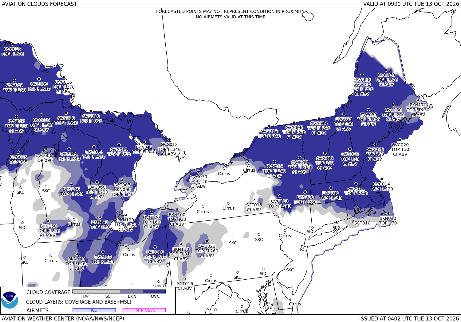





Sources: the Aviation Weather Center's data service (SIGMETs, AIRMETs, graphical AIRMETs, pilot reports, winds and temperatures aloft, observations and terminal forecasts), the National Weather Service radar, the Weather Prediction Center's charts, the FAA's temporary flight restriction list and shapes, and the FAA's airport file for the positions, elevations and magnetic variation. Fetched when the page is viewed and kept a few minutes. Each leg is the straight line between its two airports; airways, terrain and airspace are not considered. The airports in detail: San Antonio International, Norfolk International.